No audio available for this content.
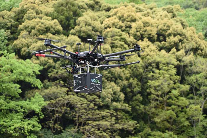
The ASTRALiTe Edge is a small-scale topographic and bathymetric scanning lidar that can detect underwater objects, measure shallow water depth and survey critical underwater infrastructure from a small UAV platform.
The patented 2-in-1 topo-bathy Edge can see beneath the water surface at depths of 0–10 meters. It is self-contained with its own INS/GNSS, battery and onboard computer. It weighs under 5 kilograms and is designed for deployment on UAV systems for faster, safer and more accurate bathymetric surveys. From coastal mapping and surveying to infrastructure inspection and military logistics, the applications of this innovative lidar are numerous and widespread.
Geo-Referencing Solution. ASTRALiTe needed a motion and navigation solution for its cutting-edge lidar. “Our requirements included high accuracy along with low size, weight and power,” explained Andy Gisler, director of Lidar Systems. Also, the system needed to be able to apply a PPK correction to the lidar data to provide higher accuracy results to ASTRALiTe’s customers.

The company chose the new Quanta georeferencing solution from SBG Systems, an INS designed to be integrated into mobile mapping systems. “The weight of the INS solution was especially important to us,” Gisler said. The Edge scanner will be flown on UAVs, where light payload capacities are required. “The ability to use two GPS antennas was key in our choice as we required good heading knowledge at slow flight speeds,” Gisler said.
Quanta directly and precisely geotags the point cloud in real time and provides even higher performance in post-processing. One year of post-processing with Qinertia, SBG’s in-house PPK software, is offered for UAV applications.
“Accurate and lightweight IMU performance leads to high accuracy lidar point clouds,” Gisler said. “Combined with the ASTRALiTe scanner and lidar performance, point clouds with typical densities of 100-300 pts/m2 and centimeter-level resolution can be achieved.”


