No audio available for this content.
“Seen & Heard” is a monthly feature of GPS World magazine, traveling the world to capture interesting and unusual news stories involving the GNSS/PNT industry.
Citizens Clean Up Coasts
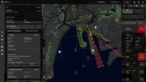
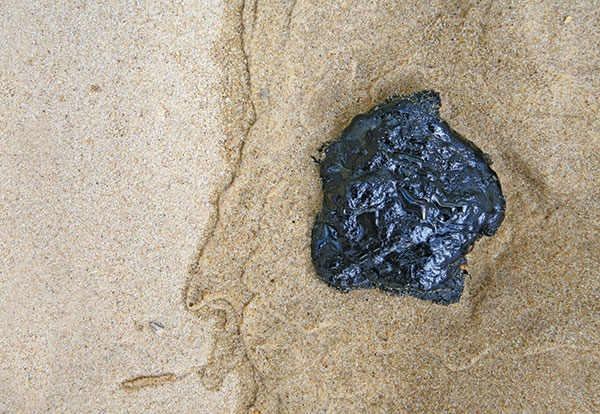
Two citizen groups are taking action with the help of Esri ArcGIS mapping tools. North Coast World Earth uses Esri Ireland’s platform on the Northern Irish coast to record litter hotspots and engage with local communities. The volunteer group has collected nearly 3 tons of litter. In California, the Surfrider Foundation employed ArcGIS Hub to streamline cleanup operations after a major oil spill off Huntington Beach in October 2021. Citizens submitted more than 1,100 reports using the ArcGIS QuickCapture photo app to share the date, time and coordinates of toxic tar balls on beaches from Oxnard to San Diego.

UKSBAS Put to the Test
A new series of tests will assess whether the United Kingdom satellite-based augmentation system (UKSBAS) for GNSS can develop into full operational capability to support safety-critical applications post-Brexit. Inmarsat, Goonhilly Earth Station and GMV NSL are conducting the UK Space Agency-funded tests. The signal is now stable and operational, enabling ongoing testing and validation by industry, regulators and users. If successful, UKSBAS will enable assessment of more precise, resilient and high-integrity navigation for maritime and aviation users in UK waters and airspace.

Smart GNSS Monitoring
More than 11,000 people around Europe and the world have turned their smartphones into GNSS monitoring tools by downloading the CAMALIOT app, so far delivering more than 53 billion measurements of meteorology and space weather patterns to researchers, reports the European Space Agency (ESA). ESA asks CAMALIOT volunteers to leave their smartphones by a window each night with GNSS on. The phones record small variations in satellite signals, gathering data for machine-learning analysis. More than 50 smartphone models with dual-frequency receivers can use the app.

Home Grown vs. Imported
Indian Prime Minister Narendra Modi gave his stamp of approval to his country’s indigenous NavIC during a drone festival May 27. Despite that, the Indian Army purchased three GNSS receivers from Baidu, a Chinese company, instead of relying on home-grown companies as the contract required, reports The New Indian Express. The receivers are for survey stations of the College of Military Engineering. A few Indian manufacturers objected to the purchase, the newspaper said, but their concerns were brushed aside by the Department of Military Affairs.