No audio available for this content.
“Seen & Heard” is a monthly feature of GPS World magazine, traveling the world to capture interesting and unusual news stories involving the GNSS/PNT industry.

Chinese surveyors take BeiDou to the top
On May 6, more than 30 Chinese surveyors left base camp to summit Mount Qomolangma — known in the west as Mount Everest. The team is using both traditional and modern surveying and mapping technologies, and China’s BeiDou Navigation Satellite System (BDS) will be applied to the elevation survey for the first time. The previous survey in 2005 used GPS to measure the height (found to be 8,844.43 meters); this year’s survey uses all four GNSS, with BDS data as the main reference.

Quantum entanglement
In a paper published April 20 in Physical Review Letters, University of Arizona engineering and optical sciences researchers, in collaboration with engineers from General Dynamics Mission Systems, demonstrate how a combination of two techniques — radio frequency photonics sensing and quantum metrology — can give sensor networks a previously unheard-of level of precision. The work involves transferring information from electrons to photons, then using quantum entanglement to increase the photons’ sensing capabilities. The quantum-sensing paradigm could create opportunities to improve GPS receivers, astronomy laboratories and biomedical imaging capabilities, as well as improve the performance of any application that requires a network of sensors.
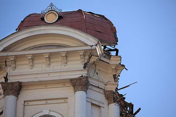
Earthquake reversal
Researchers evaluating movement of GNSS ground stations have discovered large-scale, back-and-forth ground movement preceding the 2010 seaquake off of Chile and the 2011 Tohoku-oki seaquake off of Japan. Researchers from the Geoforschungszentrum Potsdam (GFZ) with collaborators from Chile and the United States say both quakes showed multiple strange reversals of ground motion — an extremely slow “wobbling” of the continental plate — over a period of five months (for Japan) and seven months (for Chile). The discovery was made possible by the amount of data collected by the GNSS stations in both countries.
Dogbot on patrol
A robot dog from U.S.-based Boston Dynamics reminded visitors to Bishan-Ang Mo Kio Park in Singapore to maintain social distancing due to the coronavirus pandemic, reported the BBC in May. The dogbot is fitted with lidar to monitor how busy the park becomes. It also carried a loudspeaker to broadcast social-distancing messages.