Seen & Heard: March 2019
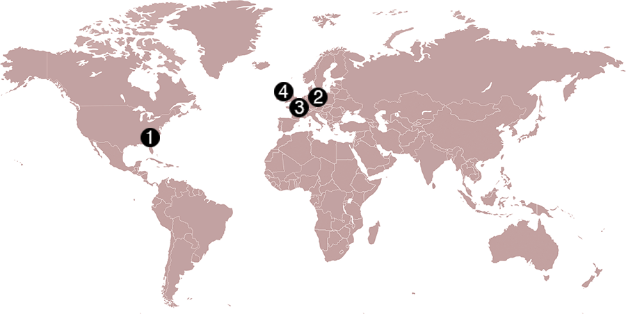
Check out some GPS developments that have recently taken place around the world. (Click to enlarge; Map: iStock.com/nadla)
1. When horses answer the call
Taking a ride in a horse-drawn carriage delights many visitors to historic Charleston, South Carolina. Until now, city crews cleaning up the presents horses leave behind have relied on flag indicators left by carriage operators. Now the city is testing a new method. Carriage operators will send the exact location to equine sanitation crews using small GPS-enabled devices. When a horse or mule takes an on-street nature break, the guide presses a button, and the equine sanitation crew is notified of exactly where to go. When the cleanup is complete, the notification is deleted.
2. Detecting rain over the ocean
Despite a wide variety of monitored geophysical parameters, GNSS signals reflected off the Earth’s surface (GNSS reflectometry) have never been used to obtain rain information. A new study presents evidence that data from the U.K.’s TechDemoSat-1 potentially enables the GNSS-R technique to detect precipitation over oceans at low winds. The study — by scientists at the GFZ German Research Center for Geosciences at Potsdam — could serve as a starting point for developing a new GNSS reflectometry application, which might also be implemented for low-cost GNSS remote-sensing missions.
3. Gaming with Galileo
Gamers around the world can now play with the Galileo constellation. Callisto for Android uses Galileo signals in a virtual maze game based on walking through a real-world location. Looking down on Earth as if from a spaceship, players use a Google Map display to traverse an area filled with randomly generated obstacles and collectibles. The project began as an entry to European Space Agency’s Galileo App Competition 2017–2018 and was one of three apps that made it to the finals.
4. Guinness decision pending on world’s steepest street
Dunedin, New Zealand, claims to have the world’s steepest street (Baldwin), a title officially challenged in January by the town of Harlech, Wales, when residents walked up and down the narrow, winding Ffordd Pen Llech carrying a GNSS surveying receiver. A total of 14 data points were recorded on the 330-meter-long road, which had an altitude accuracy of ±5 centimeters. New Zealand surveyor Richard Hemi said the GNSS method used by the Welsh group might not be accurate. Best accuracy is to survey from the center of the road — easy on Baldwin St. but much more difficult on a winding lane. The survey was sent to Guinness World Records, which will issue a decision this spring.


Follow Us