Seen & Heard: Hitchhiking marine life heads to Antarctica
“Seen & Heard” is a monthly feature of GPS World magazine, traveling the world to capture interesting and unusual news stories involving the GNSS/PNT industry.

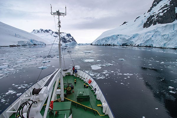
Photo: Anton Rodionov/iStock/Getty Images Plus
UNWANTED HITCHHIKERS
Antarctica’s pristine marine ecosystem, isolated for 15–30 million years, could be threatened by species such as mussels, barnacles, crabs and algae arriving on ships from 1,500 ports worldwide. A research team from the British Antarctic Survey and the University of Cambridge used automatic identification system (AIS) data, which relies on GNSS navigation data, and shipping databases to determine traffic to the Antarctic. The study is published in the Proceedings of the National Academy of Sciences, January 2022.

Photo: FrankRamspott/iStock/Getty Images Plus
QUAKE PREDICTION
Within the next 30 years, a highly destructive Nankai Trough megathrust earthquake is predicted to hit southwest Japan. Understanding long-term slow slip events under the Bungo Channel is essential for pinpointing when such an earthquake will happen. Kobe University’s Yoshioka Shoichi and Seshimo Yukinari analyzed the 2018–2019 Bungo Channel slow-slip event using longitudinal GNSS data provided by the Geospatial Information Authority of Japan. The data revealed that even though the 2018–2019 event was shorter than others, it was bigger in terms of slippage and slip velocity, as well as magnitude. Results appear in Scientific Reports, Jan. 10, 2022.

Photo: Bluesky
SUPPORTING SOLAR
British aerial mapping company Bluesky is helping Derby Homes roll out integrated solar photovoltaic systems across its housing stock. A project to identify suitable roof coverings assessed more than 8,000 addresses for size, pitch, aspect, existing structures and infringing vegetation. Using its ultra-high-resolution imagery, Bluesky determined the solar suitability of each property, the number of panels needed, and their potential output. Derby Homes recently installed its first integrated solar array on an initial batch of trial properties identified by Bluesky.

Photo: JohnCarnemolla/iStock/Getty Images Plus
TAKING MOM TIME
CQUniversity’s precision livestock management research team is using GNSS to detect calving events in extensive grazing herds. The discovery could provide beef producers in Australia with a way to remotely monitor their cattle and improve calf survival rates, one of their biggest challenges. The research project used GNSS collars with motion-detecting accelerometers on 30 cows in a 28-hectare paddock over an eight-week period at Belmont Research Station. The collars captured the animals’ location information every 10 minutes. Because the distance between mother and herd increases during calving, the data helped predict calving events, which were then visually confirmed by the research team.


Follow Us