No audio available for this content.
“Seen & Heard” is a monthly feature of GPS World magazine, traveling the world to capture interesting and unusual news stories involving the GNSS/PNT industry.
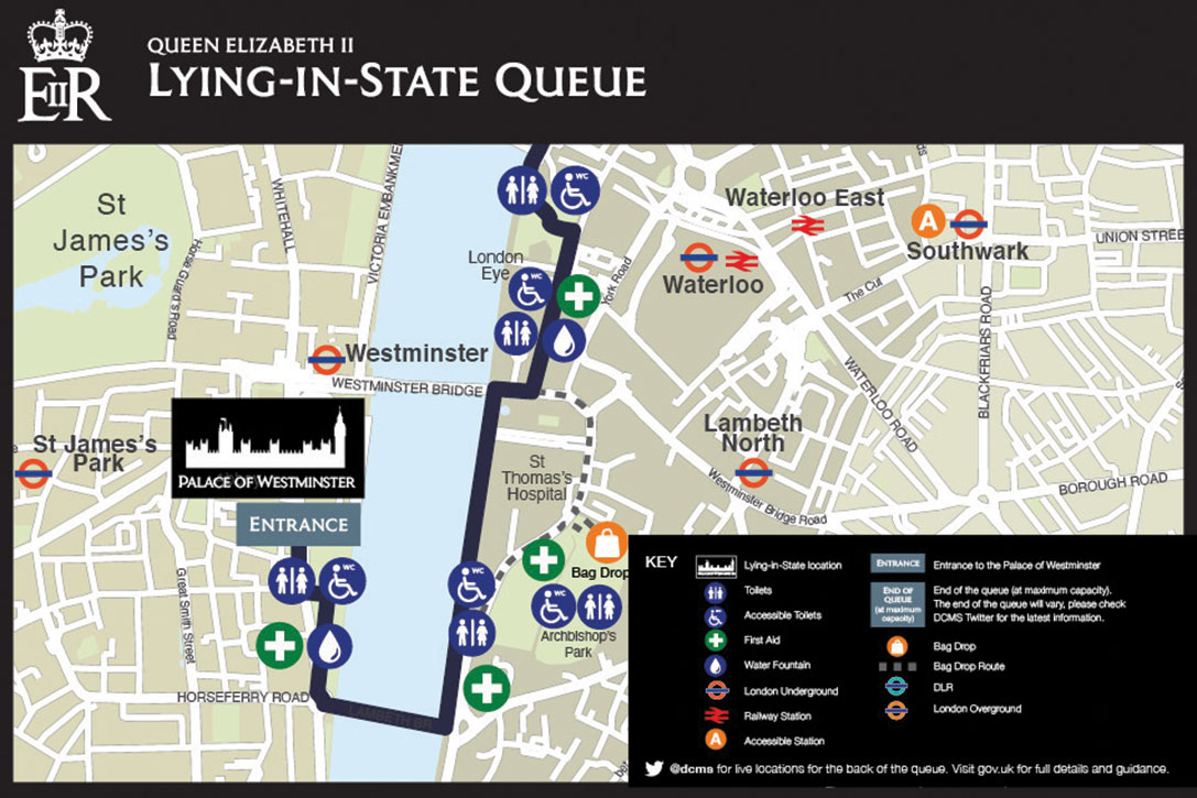
Queue Tracker for the Queen
After the passing of Queen Elizabeth II on Sept. 8, the British government launched a live queue tracker app to give people an idea how long they would have to wait to pay their respects at her lying in state at the Palace of Westminster. The app also used What3Words to help locate the end of the line using a three-word tag. The queue grew dramatically in the days before the funeral as tens of thousands lined up, some waiting as long as 16 hours. The app also showed locations of public toilets, drinking water and first-aid stations along the queue route.

A Dam Problem Solved
Lake Sarez, deep in the Pamir mountains of Tajikistan, was created only a century ago when a strong earthquake triggered a massive landslide. The area experiences considerable seismic activity, which could result in massive flooding downstream should a landslide dam break. With the help of 40 donkeys, 10 scientists and 30 staff from the National Time Service Center of the Chinese Academy of Sciences transported and installed a BeiDou-based deformation monitoring system at the dam. The team had to resolve technical problems in the rugged area, such as providing sufficient solar power and communications. With the system now operating, the dam is being monitored in real time down to the millimeter.
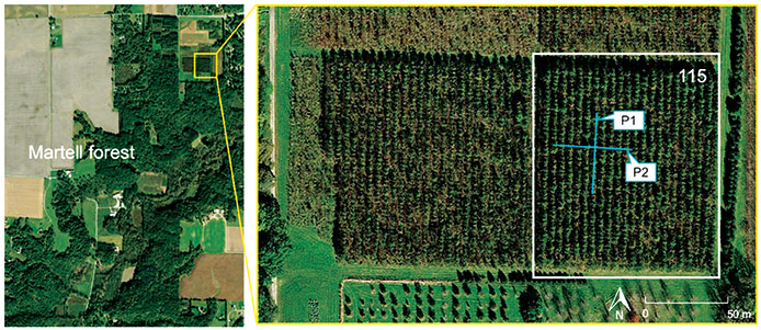
Counting the Forest for the Trees
Integration of aerial and ground-based mobile mapping sensors and systems is enabling a team of Purdue digital forestry researchers to locate, count and measure more than a thousand trees in a matter of hours. “The quick, accurate inventory of the global forest ecosystem will improve our ability to prevent forest fires, detect disease, perform accurate carbon counting and make informed forest management decisions,” said Songlin Fei, the Dean’s Remote Sensing Chair. The Purdue-made systems integrate GNSS and inertial navigation devices with lidar and cameras, deployed with manned aircraft, drones and backpack-mounted systems. The technology gathers a variety of information about each tree, including height, trunk diameter and branching formation. The team maintains the precise location and time tags of all acquired features.

Saving Ukranian Heritage
By the end of May, at least 367 incidences of destruction had occurred to Ukraine’s museums, churches, theaters and libraries. Through the project #SaveUkranianHeritage, mapping company Skeiron is capturing sites in high detail using laser scanning and photogrammetry. For a UNESCO-protected church in Lviv, the team gathered more than 300 individual laser scans and 6,000 photos to create a 3D model. The company has two laser scanners — a Leica C10 and Leica ScanStation P20, DLSR cameras and a drone. To support the project with funding or equipment, visit skeiron.com.ua/en/saveukrainianheritage/.