No audio available for this content.
“Seen & Heard” is a monthly feature of GPS World magazine, traveling the world to capture interesting and unusual news stories involving the GNSS/PNT industry.

Drones buzz warships
Several drones swarmed Navy destroyers off the California coast in July 2019, and it remains unclear who was behind the nighttime flights, according to a report on the website The Drive, quoting ship logs. As many as six drones flew around the warships at a time in often low-visibility conditions over a number of days, with the drones flashing lights and prompting security precautions onboard. The drone flights took place near San Clemente Island, home to sensitive military facilities: a Navy SEAL training site, the Navy’s ship-to-shore live firing range and an airfield. The drone flights prompted inquiries from investigators and intelligence officers in the Navy and the FBI, and are receiving high-level attention.
Blast shakes ionosphere
A 2020 explosion in Beirut, Lebanon, caused a southward-bound, high-velocity atmospheric wave that rivaled ones generated by volcanic eruptions, according to researchers at Hokkaido University in Japan. On Aug. 4, 2020, more than 2,750 tons of unsafely stored ammonium nitrate exploded, killing 200 people and leaving a 140-meter-diameter crater in its wake. To estimate variation in total electron content, the researchers collected RINEX GNSS data from 15 CORS stations in Israel and Palestine. The ionospheric disturbance was detected by differential delays of microwave signals of two carrier frequencies from GNSS satellites. The blast is considered one of the most powerful non-nuclear, manmade explosions in human history. Their findings are published in the Feb. 2, 2021, issue of Scientific Reports.
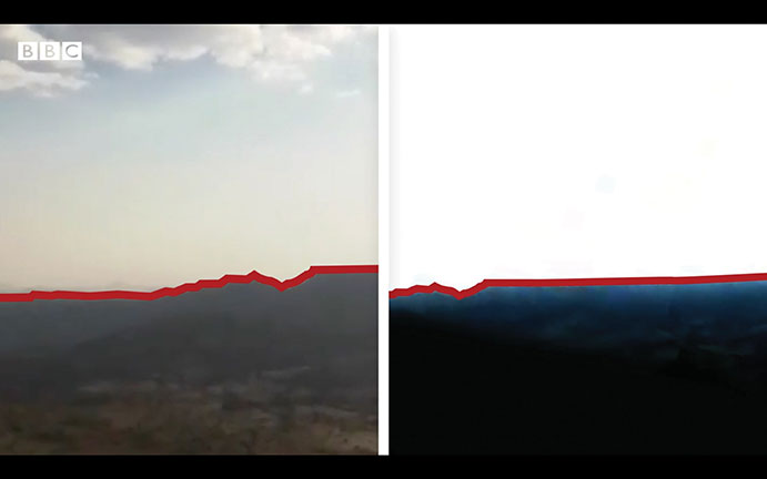
3D modeling aids investigation
Amnesty International used 3D modeling, satellite imagery and geotagged video to reveal a suspected war crime in Ethiopia’s civil war, according to the BBC and CNN. With a communications blackout in place, activists and journalists turned to mapping technology and satellite imagery to determine the location of a video provided by a whistleblower within the Ethiopian Army. A forensic frame-by-frame analysis of the footage revealed the extra-judicial execution of at least 15 young men taken from a village in Tigray by Ethiopian Army soldiers in early March.
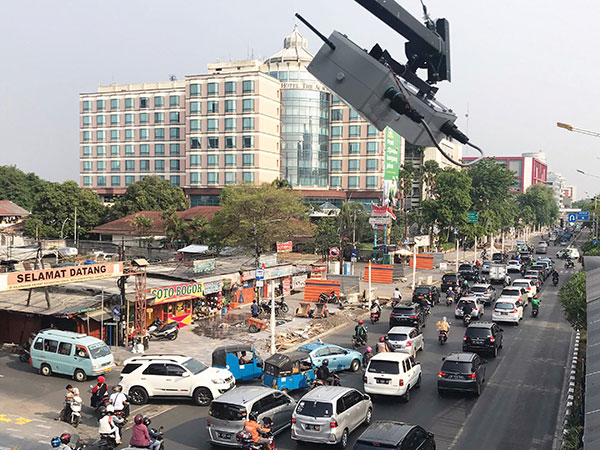
Traffic counts
In April, Murata Manufacturing began providing data from a traffic counter system that maps traffic volume with lidar technology. Murata uses lidar instead of cameras, because the technology can adapt to changing conditions, including rain and darkness. Data collected also classifies vehicle types, enabling strategic advertising and use as reference data for city planning, such as for the construction of shopping malls in locations with significant traffic levels. The service is expected to expand to Thailand and Malaysia.


