No audio available for this content.
“Seen & Heard” is a monthly feature of GPS World magazine, traveling the world to capture interesting and unusual news stories involving the GNSS/PNT industry.
It’s their land, too
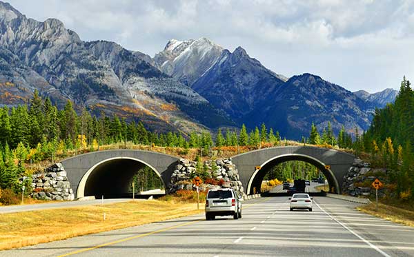
Animal tracking is helping biologists see how many animals rely on wildlife crossings over or under highways. In the United States, specially designed crossings protect pronghorn antelope (Wyoming), panthers (Florida), mule deer (Nevada), moose (Utah) and grizzly and black bears (Montana), while crossings in Asia benefit rhinos, tigers and elephants. With crossings, mortality drop as much as 90%, says The Washington Post. In New Mexico, state agencies and tribes are tagging animals with GPS collars to identify roads that hinder migration. Meanwhile, engineers in Southern California are designing the world’s largest animal crossing, an $87 million overpass that will span a 10-lane Los Angeles freeway for the region’s mountain lions.
Tesla, come to me
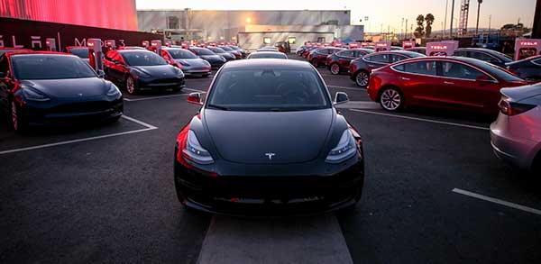
The new Tesla Smart Summon feature in Autopilot v10 autonomously drives the car to meet its owner, such as in a parking lot. Smart Summon has been used more than 550,000 times, Tesla CEO Elon Musk said on Twitter. But it has a few glitches: Owner tests have resulted in fender-benders, near crashes, ignored stop signs and a police run-in. And don’t test it with another Tesla nearby — the cars get confused.
Help, I’m shark bait!
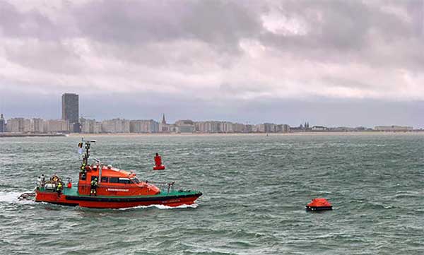
The Galileo Search and Rescue (SAR) service was demonstrated Sept. 26 off the coast of Belgium. In Operation Shark Bait, a volunteer “victim” — Australian broadcaster Tara Foster — operated her Galileo-enabled SAR beacon from a life raft off the port of Ostend. The service quickly triggered, with the rescue initiated in under four minutes.
Wheelchair navigation
A new app launched in Portsmouth, England, helps people with limited mobility plan their travel routes. The Route4U pavement navigation app benefits both wheelchair and pram (stroller) users, allowing them to discover safer, more accessible routes across the city. The app indicates pavement obstacles, surface quality, curb heights and widths, inclines and travel distances.