Quectel debuts location LTE Advanced module at CES
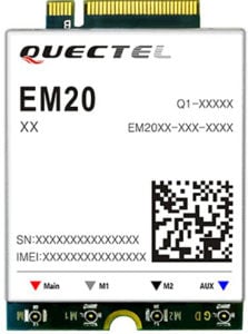
Quectel Wireless Solutions has launched the EM20, an LTE Advanced Category 20 module with location.
The EM20 will debut at Quectel Stand #2115 during the Consumer Electronic Show taking place Jan. 8-11 in Las Vegas.
EM20 offers the maximum LTE throughput of 2.0-Gbps downlink and is optimized specially for Laptop, PC and high-speed industrial internet of things (IoT) applications, the company said.
The EM20 features Qualcomm IZat location technology Gen8C Lite (GPS, GLONASS, BeiDou, Galileo and QZSS). The integrated GNSS greatly simplifies product design, and provides quicker, more accurate and more dependable positioning capability, Quectel added.
Based on Qualcomm’s SDX24 chipset and fully compliant with 3GPP R13 specification, EM20 supports LTE wireless technologies such as up to 7 Carrier Aggregation (CA), 4×4 MIMO technology, 256-QAM as well as LAA (LTE Assistant Access) and CBRS (Citizen Broadband Radio System).
The new module supports FDD LTE frequency bands of B1/B2/B3/B4/B5/B7/B8/ B12/B13/B14/B17/B18/B19/B20/B25/B26/B28/B29/B30/B66 and TDD LTE bands of B38/39/B40/B41/B42/B43/B46 (LAA)/B48 (CBRS). This ensures that IoT devices with EM20 inside can operate on networks of nearly all the mainstream carriers worldwide.
Designed in M.2 form factor and measuring 42.0×30.0×2.3mm, EM20 is compatible with Quectel’s broad portfolio of LTE Advanced products including Cat 16 module EM16 and future 5G modules, which allow for smooth migration between different categories and to next-generation connectivity.
The EM20 is designed for ultra-high-speed laptop, PC, router, industrial gateway, in-vehicle video surveillance system, cloud-based 4K IP-camera and similar applications that require high throughput and low latency.


Follow Us