No audio available for this content.
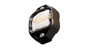
The commercially available L5-only GNSS solution includes machine-learning algorithms to leverage increased L5 signal-ranging precision in challenging signal conditions.
![]() OneNav has announced performance results from field testing its latest pureL5 customer evaluation system (CES) software in both open-sky and challenging signal environments.
OneNav has announced performance results from field testing its latest pureL5 customer evaluation system (CES) software in both open-sky and challenging signal environments.
The patent-pending oneNav GNSS system, including a custom array processor and a library of machine-learning algorithms, demonstrated consistent sub-meter accuracy and rapid time-to-first-fix (<2 sec) in open-sky testing.
In very challenging urban and deep urban canyon environments, the pureL5 CES field-test equipment outperformed the commercial precision L1 GNSS unit against which it was compared, demonstrating tracking of satellite signals as weak as –160 dBm.
The oneNav system was able to acquire directly and track L5 signals in all environments with no L1 receiver present, greatly simplifying the RF front end and antenna subsystem and making the pureL5 solution suitable for space- and power-constrained mobile and internet of things (IoT) devices requiring reliable high performance.
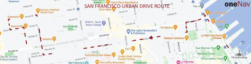
Results of a representative urban drive test route are shown below (the map describes the route driven). During this test, the CES and the commercial precision L1 receiver were both connected to a common antenna, fixes were taken once/second, and the results were compared to a common ground truth position. On average, the oneNav system demonstrated a 55% improvement in accuracy over the precision.
OneNav’s family of algorithms improves pureL5 system performance by predicting whether the received signal is line of sight (LOS) and correcting non-line-of-sight (NLOS) signals to increase the number of measurements available for accurate positioning.
The pureL5 algorithms characterize signal and multipath environments. Accordingly, algorithms developed in one deep urban area can be used to mitigate multipath in areas geographically different, but that present similar multipath signatures. This obviates the need for field-test teams to collect data in thousands of urban areas around the globe.