Listen to this content
Joint venture between DroneDash and Geodnet targets oil palm, sugarcane and broad-acre operations across Southeast Asia, the United States and South America.
DroneDash Technologies and Geonet are forming Geodash Aerosystems Pte. Ltd. — a Singapore-incorporated joint venture to develop a new class of agricultural spraying drone for large-scale, industrial farming operations. Commercial deployment is set for Q3 2026.
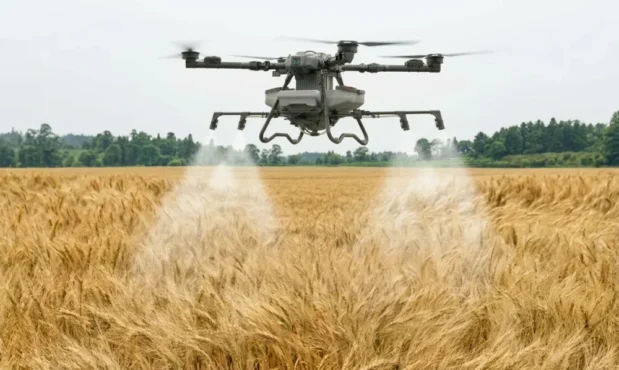
Unlike conventional agriculture drones that require repeated manual pre-mapping before each deployment, Geodash Aerosystems’ platform uses real-time AI vision and centimeter-accurate RTK positioning to perceive, navigate, and adapt dynamically during flight. The result is faster deployment, lower operating costs, and continuous agronomic intelligence from the same system that does the spraying.
Most agricultural spraying drones in operation were adapted from general-purpose UAV platforms. Before each deployment, operators must manually survey and map the field, generate static flight plans, and repeat the entire process whenever terrain, planting patterns, or canopy profiles change. In oil palm plantations and large-scale row-crop environments, this mapping overhead directly limits how many hectares a team can cover and how quickly they can respond to emerging crop conditions.
The operational constraints are compounded the larger the estate. Manual pre-survey and field mapping is required before each deployment. Static flight plans must be recreated when terrain or canopy profiles change. Plans have limited adaptability to uneven terrain and mixed-age crops, when erosion or other changes occur.
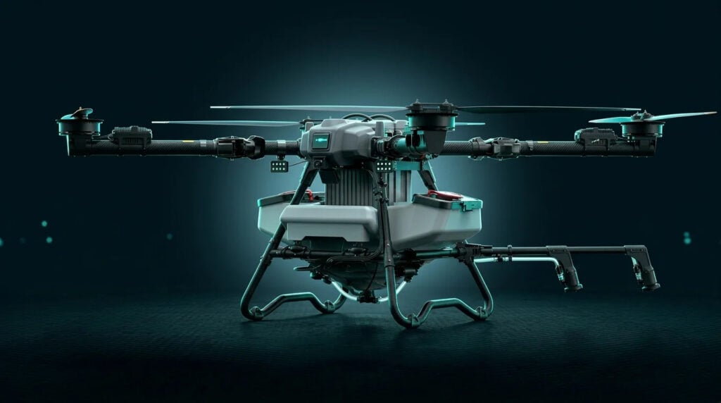
Geodash Aerosystems’ drone architecture removes pre-mapping from the deployment workflow entirely. Using DroneDash’s proprietary AI vision system, the aircraft performs real-time perception of plantation structure, canopy height, and terrain features during flight. Geodnet’s RTK correction network delivers centimeter-level positional accuracy throughout each mission.
This combination enables:
- deployment without pre-mapping or manual mission surveys
- dynamic interpretation of rows, trees and operational zones
- continuous altitude and spray-rate adjustment over variable terrain
- rapid redeployment after replanting or field reconfiguration
- tree-level and zone-specific variable-rate application.
Situational awareness is generated dynamically during flight — not through a separate pre-deployment process. Each aircraft maintains geofencing controls, safety constraints, and full operational data logging for regulatory compliance and audit traceability.
Agronomic Intelligence Layer
Each GEODASH Aerosystems drone is integrated with DroneDash’s AI Smart Farming backend, which transforms every operational flight into a continuous data-collection activity. Spraying missions generate field data used to produce:
- canopy density and uniformity analysis
- crop stress and anomaly detection
- zone-level health scoring
- spray effectiveness validation
- terrain and drainage profiling
- historical trend analysis across blocks and seasons.
Backend AI analytics then deliver actionable decision support to plantation managers and agronomy teams: early indicators of pest, disease, or nutrient stress; identification of underperforming zones; optimized spray timing and dosage; and data-informed planning for replanting and fertilization. The drone functions as a continuous aerial intelligence layer, not a standalone spraying machine.
Geodash Aerosystems targets industrial agriculture markets where deployment speed, terrain adaptability, and precision matter most: oil palm plantations in Southeast Asia; sugarcane, soybean and corn operations in the United States; and palm, sugar and broad-acre estates in South America.
Pilot deployments and system validation have been conducted throughout 2025 and into early 2026 in collaboration with plantation operators. Commercial deployment is targeted for Q3 2026, following completion of manufacturing readiness and regulatory approvals.


