Microchip updates BlueSky GNSS Firewall Software
U.S. Department of Homeland Security’s live-sky testing evaluations influenced development of BlueSky GNSS Firewall Software Release 2.0
Microchip Technology Inc. has released a major software update for its BlueSky GNSS Firewall product, providing a higher level of resiliency against GPS vulnerabilities for systems dependent on GPS signal reception.
Such systems include critical infrastructure such as power utilities, financial services, mobile networks and transportation that rely on GPS-delivered timing to ensure ongoing operations.
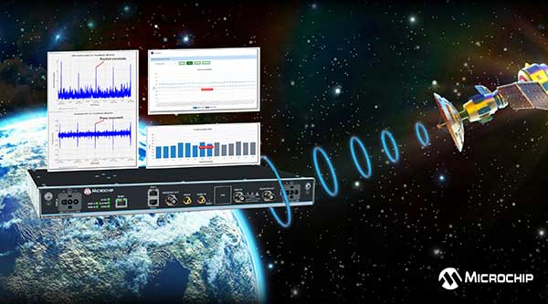
Microchip’s BlueSky GNSS Firewall Software Release 2.0 performs real-time analysis to detect jamming and spoofing for protecting reception of the GPS signal and hardening response and recovery to avoid signal disruption.
Release 2.0 includes charting and advanced threshold settings of GNSS observables such as satellites-in-view, carrier-to-noise, position dispersion, phase time deviation and radio frequency (RF) power level to simplify system turn-up and deployment.
The release also includes improvements developed by Microchip as a result of participation in a 2019 industry live-sky testing event hosted by the U.S. Department of Homeland Security (DHS) Science and Technology Directorate.
Microchip’s participation in the DHS-hosted GPS Testing for Critical Infrastructure (GET-CI) events included scenarios with spoofed signals, and helped the company identify new solutions to prevent signal disruptions. As a result, Microchip developed the Release 2.0 to address operators’ evolving requirements.
As a leader in frequency and time systems, Microchip continuously innovates GPS signal reception security technologies for commercial and military operators similar to how network firewalls protect against virus threats. Updates are essential to defend against rapidly-evolving GNSS disruptions and enable critical infrastructure operators to avoid interruptions of service.
When connected to Microchip’s TimePictra management software, critical infrastructure operators can monitor and analyze GNSS signals in cities, across geographic regions, throughout a country and even globally.
Other complementary devices and software in Microchip’s suite of GPS systems and services include the TimeProvider 4100 Precise Timing Grandmaster with Gateway Clock, SyncServer 600/650 timing and frequency instrument, miniature atomic clock (MAC), Time Cesium and 5071A cesium primary frequency standard.


Follow Us