No audio available for this content.
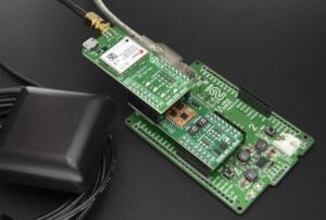
Using lasers in conjunction with GPS can collect richer data, faster, and streamline survey and mapping projects across many disciplines that draw on mapping and geospatial information systems.
To learn more about the exact processes involved in Integrating a professional measurement and mapping laser to your GIS toolbox, both saving time and enabling collection of additional attribute data attend GPS World’s free webinar on Thursday, Aug. 16: LaserGIS: Your Gateway to Collect More GIS Data in Less Time.
The webinar will be available for download 24 hours after broadcast time, for those unable to attend live.
The applicable fields for this enabling technology include surveying, construction, ecosystem management, watershed analysis, geological mapping, environmental impact assessments and more.
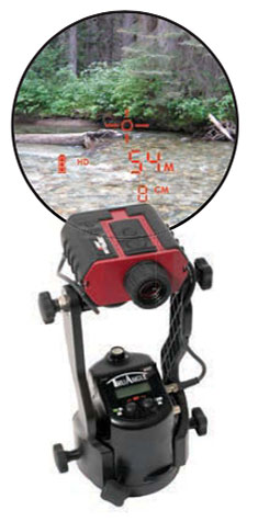
A natural resources ecosystem manager said, “I map areas that are either impossible to occupy or simply can’t be disturbed, so using laser-based reflectorless measurement technology is ideal for wildlife habitat research. When performing soil surveys, I can easily calculate the grade of a slope by using the missing line routine. I even used the Laser Technology TruPulse once to track the progress of a wildfire. This technology is a must-have for our crews because it’s highly portable and produces reliable data.”
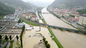
A land conservation specialist performing watershed analysis added, “Stream channel surveying tools have come a long way since I graduated college. I’m now able to mark a stream’s course, calculate the gradient and measure the width of the riparian zone, all with a simple point-and-shoot TruPulse laser. For wetland delineation projects, being able to shoot directly to the bank saves a huge amount of time and keeps me and my crew as dry as possible.”
A geologist performing mapping as part of his work routine said, “I need to accurately track geological structures in mines and outcrops, and would really struggle with collecting measurements if it wasn’t for my TruPulse 360. With the laser, I can get a measurement to any type of surface and don’t have to stand in dangerous areas, so I can be extremely productive and safe. When I have to verify the volume of our biomass stockpile, I just integrate my laser with MapSmart and get reliable calculations in minutes, right in the field.”
Finally, an archaeologist performing an environmental impact assessment stated, “Conserving archaeology sites is just as important as researching and analyzing them. Integrating the TruPulse with GPS allows me to make better planning decisions with all types of resource considerations without compromising data integrity or delicate areas. The TruPulse’s onboard solutions for height and 3D missing line make my job so much easier and far more productive than conventional measurement tools.”