No audio available for this content.
New solution integrates the real-time Kongsberg IRIS UAS airspace management picture into the AiRXOS’ Air Mobility Platform to provide integrated unmanned traffic management services around critical infrastructure
AiRXOS, part of GE Aviation, has fully integrated the real-time airspace picture from the Kongsberg Geospatial IRIS airspace management application into its own Air Mobility Platform for unmanned traffic management.
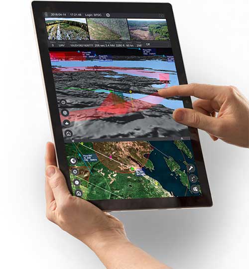
IRIS UAS fuses multiple disparate, real-time sensor feeds to create a highly accurate airspace picture around critical infrastructure locations such as airports.
This provides real-time calculation of aircraft separation, airspace monitoring alerts and communications line-of-sight prediction to enable detect and avoid for safe beyond visual line of sight (BVLOS) operations.
The real-time local airspace picture is then integrated into the cloud-based AiRXOS’ Air Mobility Platform, a dynamic, cloud-based foundation, purpose-built for advanced operations and the evolving future of transportation.
The Air Mobility Platform manages the volume, density, and variety of unmanned traffic management (UTM) data, and provides enterprises with a single platform to connect and manage operations, applications and devices.
Through this collaboration, the companies will provide UTM customers with a fully integrated view of airspace for real-time airspace insights, and greater scalability and repeatability of advanced operations.
“Situational awareness of the airspace across applications, unmanned aerial system (UAS) advanced operations, conformance monitoring, compliance, and pilots is critical to a UTM environment — allowing enterprises to be more responsive and efficient,” said Ken Stewart, CEO, AiRXOS. “Our partnership combines Kongsberg Geospatial’s expertise in airspace management with AiRXOS’ dynamic platform, applications, and services, providing customers with the opportunity to truly scale critical infrastructure advanced UAS operations like BVLOS and multi-vehicle, helping to lower risk and increase savings.”
“We’re very pleased to be working with an unmanned traffic management innovator like AiRXOS,” said Ranald McGillis, president of Kongsberg Geospatial. “Their ability to create a comprehensive surveillance view of operations and then to scale it for a nationwide use provides an excellent and very unique use case for our technology.”


