No audio available for this content.

Garmin International Inc., a unit of Garmin Ltd., maker of popular GPS devices such as the nuvi, has announced its first Wi-Fi-enabled outdoor handheld GPS running the Android operating system, Monterra.
Monterra has a vivid, sunlight-readable touchscreen, and users can easily access the Google Play Store and download apps through an available Wi-Fi connection on the device. Developers can create new apps that are suited for the rugged, waterproof, and sensor-loaded handheld device.
“Monterra provides outdoor professionals and enthusiasts with the ultimate ability to customize their GPS device to perfectly suit their personal and professional needs,” said Dan Bartel, Garmin’s vice president of worldwide sales. “With a four-inch, color, multi-touch display, unique 3D MapMerge, and the ability to create new apps, Monterra takes the outdoor GPS to a whole new level, and users are able to take advantage of the features no matter how adverse the terrain may be.”
With the Android operating system, users are able to access popular outdoor-related Android apps, such as Peak Finder, as well as professional apps like construction estimators and ArcGIS to extend some office functions to the field. Monterra also has a built-in FM radio and NOAA weather radio with SAME alerts, so users can receive watches and warnings related to their location. Users can either listen with headphones or through the built-in speaker.
Monterra has a built-in 3-axis compass with accelerometer and gyro, which indicates the user’s direction even when standing still or not holding the device level. Its barometric altimeter has the ability to track changes in pressure to pinpoint precise altitude, and it can also plot barometric pressure over time to monitor weather conditions. It also has a built-in UV sensor so users can monitor the intensity of the sun, and reduce exposure if necessary. With its high-sensitivity, dual-band GPS and GLONASS receiver, Monterra finds its location quickly and maintains signal lock even in heavy cover and deep canyons.
New to the Monterra is a unique mapping feature: 3D MapMerge. With this feature, users can combine two maps — like TOPO, basemap, or BirdsEye Satellite Imagery — then view the new unique map in three dimensions. Hills, valleys, lakes, roads, and points of interest combine to give Monterra’s maps unequaled detail and richness. Combine BirdsEye with TOPO US 24K, or a GIS-based water table map with a shaded relief basemap, then zoom in, pan out, and rotate the 3D map using multi-touch.
Monterra has a built-in 8-megapixel autofocus digital camera that takes geotagged photos, plus a 1080p HD video camera with LED flash. Users can download photos and videos to their computer for either work or sharing using Garmin Adventures. Monterra has 8 GB of internal memory built-in plus a microSD slot for even more extra storage.
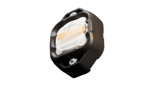
Monterra features a vivid and highly durable mineral glass display that uses sunlight in combination with the unit’s LED backlight to increase brightness and view-ability. It has an IPX7 waterproof rating and also uses a dual-battery system, which allows users the option of using the rechargeable Li-ion pack (included) or traditional AA batteries. It is also compatible with the same mounts as the Garmin Montana, so users can take Monterra anywhere.
Wireless sharing is easy with Monterra. It has WiFi, ANT+, Bluetooth 3.0 and NFC capabilities, which allows users to share data, maps, waypoints, tracks, routes, and geocaches with other wireless compatible devices. Additionally, Monterra is compatible with BaseCamp, a free software download that lets you view and organize maps, waypoints, routes and tracks.
The new Garmin Monterra will be available third quarter 2013 at a suggested retail price of $649.99 (Worldwide with preloaded worldwide basemap), and $699.99 (U.S. with preloaded TOPO U.S. 100K with Navteq roads).