No audio available for this content.
![]()
The European Space Agency (ESA) has funded Ampyx Power, developer of a next-generation wind energy technology, and Omnisense, developer of locating and tracking solutions, to develop a robust fail-safe navigation system.
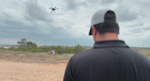
The positioning solution will be used for automated take-off and landing of Ampyx Power’s wind-energy aircraft when applied offshore or over rugged terrain. The technology will be enabling as well for other drones in critical applications.
Ampyx Power develops airborne wind energy systems (AWES) using autonomous tethered aircraft as a means for generating electricity on the ground. The launch and land deck is smaller than the wing span of the aircraft. High accuracy, availability and integrity of the relative positioning between aircraft and platform is required during the final horizontal approach to ensure safe landing of the aircraft in the case of GNSS outage.
The funding will cover the integration into the navigation solution of a local positioning system that seeks to provide 10 centimeters of relative positioning accuracy with 100-Hz update rate and an operating range up to 1 kilometers. Ultra-wideband positioning techniques will be used to make this happen.
“The project allows us to integrate a backup local positioning system into the existing high-end navigation solution,” said Michiel Kruijff, head of technology at Ampyx Power. “This novel navigation technology will ensure that our aircraft can overfly the platform with great accuracy, even in case of GNSS failure. This solution is particularly relevant for use cases in rugged terrain or offshore where other affordable means of relative positioning would be too costly or would offer insufficient performance or availability. We seek such a high level of system robustness both for commercial reasons and for safety reasons, in line with our certification approach with the European Aviation Safety Agency (EASA).”
“We are pleased to offer our innovative local positioning system (LPS) to this project,” said Andy Thurman, CEO at Omnisense. “The closely time-synchronized fusion of ultrawideband (UWB) signals exchanged between landing deck and aircraft mounted Omnisense beacons, will allow highly accurate range measurements to be provided to the drone autopilot, enabling continuous operation in the safety critical landing phase. The enhanced capabilities which arise as a result of this project will enable Omnisense to extend the market reach for our flexible LPS offering from the industrial asset and animal tracking markets in which we currently operate, to more dynamic applications such as GNSS denied drone control, autonomous vehicles in smart cities and sports performance analysis.”