No audio available for this content.
Line of sight to GNSS satellites is sometimes obscured by buildings and trees, which also cause multipath, as does nearby water. These conditions require an RTK receiver with multipath mitigation. Often, surveying must occur on property corners or on uneven ground, where it is hard to place surveying equipment. For these reasons, reliability and accuracy are essential, especially in harsh environments. Ground control points require 1-2mm accuracy and topo surveys 1-2cm accuracy. Surveying for AEC also requires software that processes digital files.
ComNav has focused on GNSS core technology innovation and applications for 10 years. The Quantum III technology includes algorithms to suppress multipath and supports all GNSS constellations, allowing the users to acquire and keep RTK centimeter accuracy even in harsh environments. The built-in tilt IMU will help where the exact location to be surveyed is hard to reach. For example, the T300 Plus and N Series GNSS receivers support a maximum pole tilt of 60° and keep the compensation accuracy within 2.5cm, making the field work more efficient, convenient and reliable.
With the Survey Master software’s stake-out points, users can import DXF or DWG files directly and the software can stake out the point, line and surface in CAD.
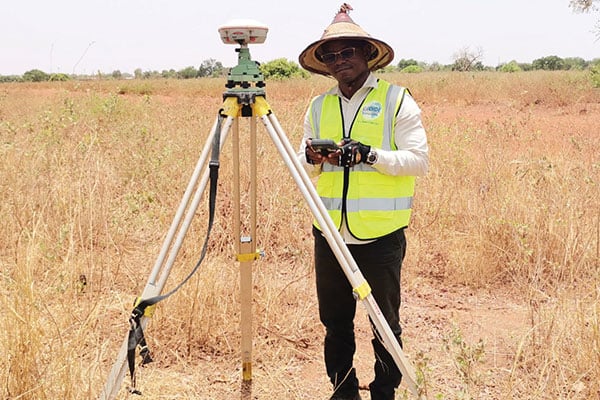
In April 2021, the government of Burkina Faso used ComNav GNSS T300Plus to provide ground control points survey for the construction of a hospital.
The land security and topographic surveying were completed within only six days, less than half the time that had been scheduled for those tasks. This greatly expedited the construction of the hospital and helped with the fight against infectious diseases, including COVID-19.


