No audio available for this content.
Auterion has introduced new capabilities for high-precision mapping missions and automated, end-to-end data workflows to make mapping more efficient, reliable and powerful across industries.
Unveiled at AUVSI Xponential 2022, updates to the Auterion OS serve enterprises with diverse use cases that need component and payload flexibility, alongside a centralized and streamlined software workflow.
Advantages for customers include:
- Availability of precise mapping data in real time and automated processing that enables fast decision-making, saving time, ensuring consistency and reducing human errors.
- Standardized process across any Auterion-powered vehicles, bringing an improved user experience, reducing training time, and affording easy scaling of operations.
- Connectivity that enables automated end-to-end workflows with no need for manual data transfer, and integration with third-party data-processing software such as Esri Site Scan or Propeller.
“The mapping and workflow features included in this latest release of Auterion’s software focus on use cases from our enterprise customers,” said Markus Achtelik, vice president of engineering at Auterion. “We’re making sure that workflows are thoughtfully designed to meet customer needs and that the data they require is collected, automatically processed and streamlined through Auterion’s software platform for immediate use and longer term analysis.”
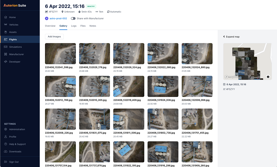
Auterion’s new platform capabilities are achieved through the enhancement of tightly integrated components. For example, the ground control app provides precise mission execution with fully integrated control of payloads, such as the Sony α7R IV camera. Then, capture and storage of geotagged images on the drone occur in real time.
Next, image data correction and processing happen seamlessly. This kind of automated workflow illustrates Auterion’s commitment to building efficient operational solutions for enterprise-ready drones, the company said.
“Auterion’s software is updated with its expanding open ecosystem in mind,” added Achtelik. “That gives customers the best options on the market, offering greater flexibility and choice to meet enterprise quality, scale, and regulatory needs.”


