No audio available for this content.
1Spatial has extended the capability of its survey application 1Edit, increasing support for photos and 2.5D data.
1Edit 3.1 allows users to attach feature photos, including automated geotagging, which enables surveyors to visualize assets and fine-tune their observations. The latest version now includes new validation functions and improved handling for heights (2.5D data), typically useful for detailed asset and land-management surveys.
Enhanced styling, including bitmap fills and dashed lines, make it easier to identify and classify different asset types during surveys. Additional control of editable layers and fields provide protection for non-editable data and protects the quality of data. Significant improvements to rendering of thematic mapping further enhances the speed and fluidity of the intuitive user interface.
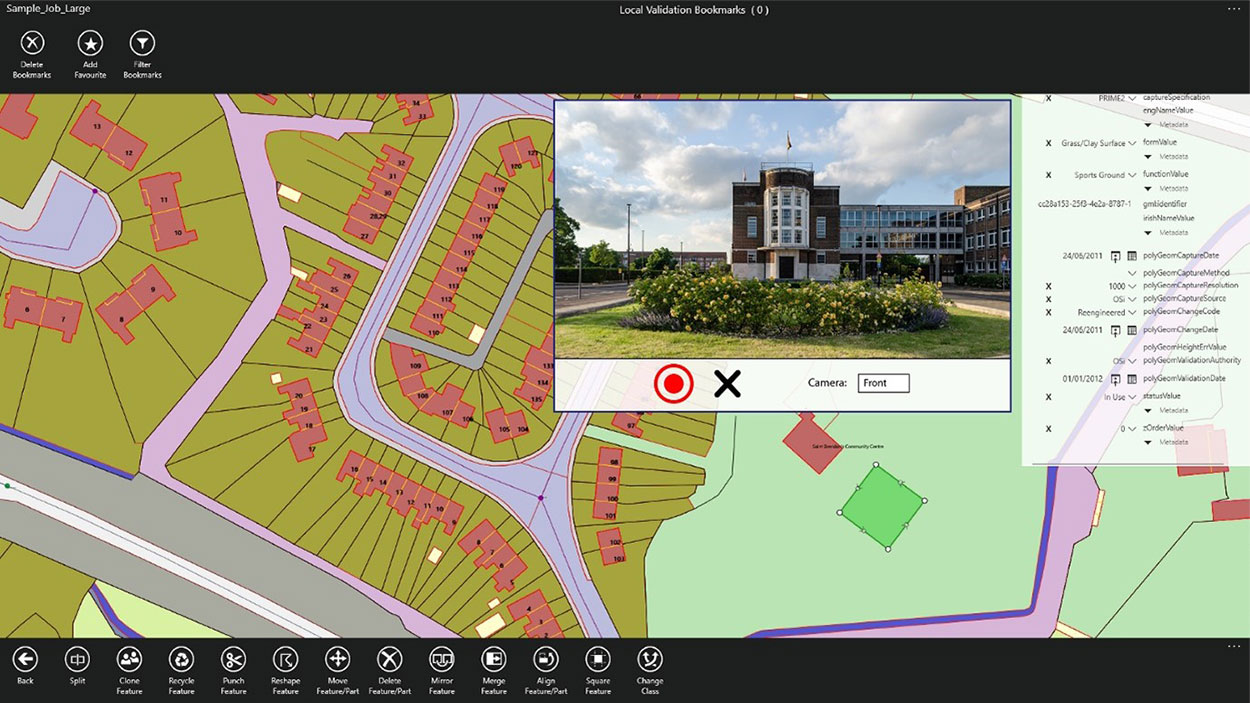
1Edit also now supports the storage of photographs as an attribute on a feature. The photos can be captured from the front or rear camera and are stored as a Label object.
“1Edit’s new survey capabilities further expands our customers’ ability to collect trusted, validated data that is right first time,” said Robert Chell, chief product officer. “By increasing the number of validation options available during a survey, we improve both the quality and accuracy of data, and the effectiveness of survey processes.”


