August 7, 2024 TRB ADK70 Standing Committee on Geospatial Data Acquisition Technologies summer meeting By David B. Zilkoski
July 2, 2024 NGS new alpha preliminary products in support of the modernized NSRS By David B. Zilkoski
January 3, 2024 Time is running out to submit GNSS or leveling data for initial NSRS modernization By David B. Zilkoski
January 5, 2022 GPS World contributor Tim Burch appointed executive director of NSPS By Tracy Cozzens
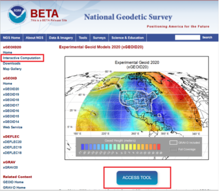
February 3, 2021 NGS releases annual experimental geoid models and gravity interpolation tools By David B. Zilkoski