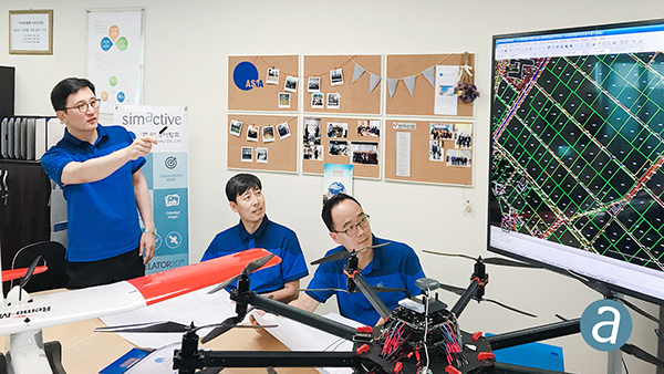
TAG: SimActive

SimActive speeds stockpile measurement with drones

March 3, 2020

Photo: SimActive

SimActive used to determine financial assistance after Hurricane Dorian

October 25, 2019

This article is tagged with , , , and posted in Latest News, Mapping

SimActive software used with eBee X for shoreline mapping

April 17, 2019

SimActive software speeds large-scale photogrammetry project

November 27, 2018

Aerial imagery of the devastation from Hurricane Michael in Mexico Beach, Florida. (Image: SimActive)

SimActive’s Correlator3D used to assess Hurricane Michael damage

November 5, 2018

Photo: SimActive

First South Korea government drone project completed with SimActive

September 17, 2018

This article is tagged with , , , , , and posted in Latest News, Mapping, UAV/UGV

SimActive updates Correlator3D for mining

September 5, 2018

Image: GPS World

SimActive launches free data-processing service using Correlator3D

March 16, 2018