No audio available for this content.
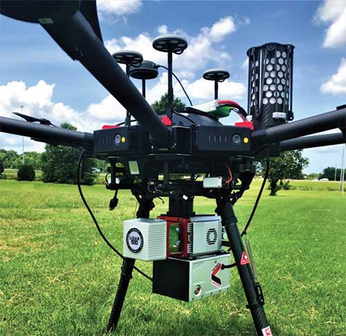
Lidar USA is now offering the option of the Drone Rescue Systems parachute system with all of its DJI M600 UAVs.
As UAVs become increasingly common for mapping applications, the likelihood of a crash increases. The number-one concern for any pilot should be the safety of all people in the vicinity. Equipment safety is number two.
Any mapping-equipped drone will have enough weight to potentially harm a person even if falling from a low altitude flight. The Drone Rescue System greatly mitigates this danger and gives pilots the added assurance that, should the system fail, they have gone the extra mile to prevent harm to any bystanders.
Effective as low as 10 meters with a descent of 3 meters per second, the equipment will land without a hard impact yet quickly enough to keep from being dragged far away.
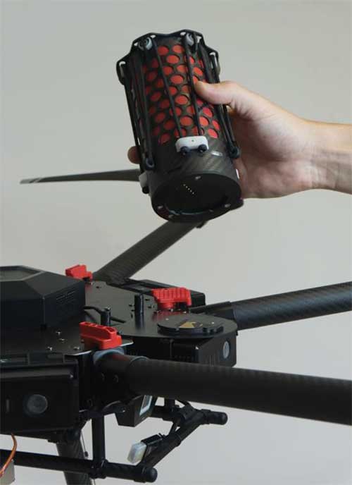
Weighing in at 430 grams in a repackable canister 160 x 75 millimeters in size, the DRS-M600 is designed to auto-release using a patented, airplane-friendly ejection mechanism within milliseconds of detecting a system failure. The size and weight are a major bonus when combined with the airplane-friendly feature, especially for field workers, according to the company.
“We performed our own tests of the Drone Rescue system to ensure the system really worked as advertised,” said Daniel Fagerman, CTO of Lidar USA. “We weren’t disappointed. While it’s an expensive test if it fails, the good news is it that the system worked as well as could be expected. The M600 incurred very little damage that was easily repaired. We feel confident this will be more than just an accessory for our clients but rather a necessity.”
Lidar USA is offering the parachute option to any M600 owners. Watch a video of one of the company’s test flights.