No audio available for this content.
By Matteo Luccio, Editor-in-Chief
Your father was an electrical engineer, and one of his projects was inertial navigation for aircraft carrier landing for the British Harrier attack aircraft, correct?
That is correct. During the 1982 Falklands War, the British had two versions of the Harrier — one for the navy and one for the air force. They flew the RAF Harriers down to meet the carriers en route, landed on the carriers, then had to update the software on the ship so that they could take off again because the two versions of the plane didn’t have the same software.
The stories your father told you and your brother in the car sparked your initial interest in engineering, right? What turned that into a passion?
My father got into inertial navigation right after the war, when it was groundbreaking. He was recognized for many achievements. He was given the gold medal by the Royal Institute of Navigation. He had an Order of the British Empire for all his contributions. Some of his equipment is in the Imperial Museum. What excited me was that he got into a field that was brand new, and a lot of stuff just hadn’t been done yet, so he got to do the first of a lot of things. I was very interested in engineering. In particular, when I was at university, Transit [the first satellite navigation system, operated by the U.S. Navy starting in 1964] was still brand new. I saw that this was an exciting field.
It sounds like his enthusiasm was contagious.
Well, I wouldn’t say that, actually, because my father was dead set against me being an engineer.
I mean his enthusiasm for the subject.
Yes.
I read that among your father’s projects were mechanical moving map systems. How did those work?
It was a camera film with a map on it. If you were going north or south, it would scroll up or down. If you were going east or west, it would jump from frame to frame.

You earned a B.A. in engineering from Cambridge University, an M.S. in aeronautics and astronautics from MIT (by the way, I also got my master’s there a few years after you, but in political science), and a Ph.D. in mechanical, aerospace, and nuclear engineering from UCLA. What guided you through your studies? Did you know your heading, pun intended, from the start?
As I said, I wanted to do engineering. Cambridge has a very general engineering program. When I was there all the students took the first two years. It’s changed since. I really didn’t get to focus on what my interests were until the third year, which was your final year, when you got to pick four topics in which to specialize. When I really got specialized, I was working on control systems, electrical systems, surveying (for which we were using Transit), and astrodynamics. So, it was a smorgasbord, but it fit very well with going into navigation solutions — both for inertial navigation systems, in which I worked first, and then for GPS, when it evolved.
I was very lucky. You asked what got me passionate. I had some fabulous instructors at Cambridge with whom I stayed friends for many years. One of them, Donald Green, unfortunately passed away a few years ago. I still stay in touch with another one, Keith Glover. So, I was very fortunate, wherever I went, in getting superb professors who took an interest in me and encouraged my passion.
That’s great. For one of your degree programs, you did a summer project that you once said combined your love of the outdoors with your love of technology.
My Ph.D. at UCLA was on surveying using GPS, and that was the world’s first GPS-based survey.
When Litton hired me, I first worked on inertial navigation solutions for them, then they started a GPS development effort. They very graciously gave me a day a week to do my own research. The rest of the time, I worked on building one of the very first aviation GPS receivers.
That receiver was the first of its kind, in that it could track carrier phase. Most of the receivers at that point couldn’t. They were what was called slow sequencing receivers, because they switched from channel to channel. Of course, you don’t carry phase-lock across those switches. Having worked with Transit, I knew how to use it for surveying. So, I did my research on how to use GPS for surveying and my thesis was on using what we called accumulated delta range, which is essentially carrier phase tracking for surveying.
At the time I was doing that research, John Ladd, who ran Novatel for a while, was also working for Litton, doing surveying for oil wells using a codeless tracking technique that Charles Counselman had developed at MIT. Counselman was adamant that you couldn’t use GPS codes for surveying but had to do codeless tracking, which he was doing. Of course, he was wrong. So, John and I collected the very first carrier phase observations to compare against the long baseline positioning that Counselman was doing. That was back with only four hours of GPS satellites a day, so we were taking data throughout the night. Floppy disks filled up every hour, so he took me to a different pub after each disc. We named the disks after the pubs.
What was your principal motivation and aim in founding NAVSYS in 1986?
It was a direct result of me getting married and moving with my husband to Colorado, where I’ve lived ever since. Obviously, back in 1986 GPS was still very new. I had my Ph.D. by then. UCLA had me teaching short courses in GPS, which were some of the first courses on the subject. Litton asked me to stay on working for them as a consultant. So, I set up NAVSYS for my consulting work. I was also still teaching the courses.
I learned very quickly that I was much more interested in doing things than in talking to other people about doing them, which was the case for both the teaching and the consulting. By then, the federal Small Business Innovation Research (SBIR) program had started. I found out about it, started writing SBIR proposals, and won contracts. That was great because then we got to do stuff. That was really what got NAVSYS started. We built some very innovative technology using the SBIR program.
What does NAVSYS do? What do you do at NAVSYS on a typical day? What is NAVSYS’s R&D agenda now and what is the balance between the R and the D?
I still stay very heavily involved with the engineering team. I style myself a systems engineer. I have a pretty broad engineering background and a very strong analytical background. So, I still do a lot of the algorithm development and a lot of the simulations. Before we try and build anything, we always prove it first through simulation. That’s why we have such a great success record, because we never try to do anything that’s impossible. It’s usually difficult, but not impossible. So, I stay very heavily involved with that side.
I also run the company. As the CEO, I am responsible for operations, finance, and charting the strategic direction. We’ve expanded into Europe and we’re also preparing to expand into other areas of the world, in conjunction with partners.
SBIR stands for small business innovation research, but I would put everything we’ve been doing in the development bucket. Often, we’re doing it first. Right now, we’re focusing on our flagship product, which we call PNT as a Service (PNTaaS). It’s the only non-L band alternative to GNSS today. The only other commercial PNT service that’s operating today is Iridium, but that’s also operating in the L band, so it’s getting denied as well. We’ve rolled out PNTaaS in the United States. It’s very much still in the development phase. We’ve got it operating, but we’re working with partners to integrate it into different product lines. We just conducted a very successful test at Jammertest in Norway and we’re building out our network of reference stations in Europe. We expect to be going into operational trials on that early next year.
Your work on the FAA’s Wide Area Augmentation System (WAAS) was one of the bases for the Japanese MSAS, the country’s satellite-based augmentation system. Did you go to Japan for that or did Japanese engineers come visit you?
They came to visit us and we visited them. Actually, I believe they’re still using our equipment! It’s lasted a long time.
Brad [Dr. Bradford Parkinson] points out that there have been no fundamental changes to GPS in the past half century and the original design has held up very well.
I’m not sure I’d agree with that statement. There have been quite a few changes. It certainly has been evolutionary rather than revolutionary, but there have been a lot of changes.
What role has GPS World played in the development of GNSS and of PNT more broadly?
It’s a good question. Brad and I started the Institute of Navigation’s Satellite Division and the first GPS trade shows were part of the satellite division’s conference. I ran the first four of them. At that time, there were no GPS trade shows and ION saw GPS as a threat to the old school — which it was, in a good way. GPS World, as I recall, was the first publication on GPS. If you look at things that are important in promoting the commercial use of GPS, I would certainly give credit to the satellite division and the conferences that we ran, which brought the industry together, but GPS World was a very important part of that too, providing the first dissemination of notable events.
How has the ION GNSS+ conference changed since the first ION GPS conference in Colorado Springs in 1987, for which you were the principal organizer?
Well, they stopped having the parties! We used to have some very fun parties. They gave me carte blanche running the conference. One of the things I never liked at the conference, unfortunately, was the sit-down dinners, which we had at the last one. You know, in a stuffy hotel room. We had more social events, which were very well received. They haven’t been doing those for quite a while.
Did the Federal Communications Commission’s 1996 E911 location mandate spur the development of GPS-enabled cell phones, or did the FCC take advantage of what was happening anyway?
As you know, we were integrally involved. I would put it a different way. First of all, the FCC’s 911 mandate per se didn’t say that you had to use GPS. At the time, none of the commercial receivers met their requirement. The problem was not accuracy; it was the time to first fix. To support 911 calls, you need location tied in with 911, but at that point in time, it took a couple minutes for most receivers to acquire the information from the satellites. Network-assisted GPS didn’t exist. We invented that.
Did the FCC issue the mandate knowing what was soon to be possible?
We had demonstrated that it was possible to meet the requirements using the first network-assisted GPS solution, which was our LocatorNet. The problem at the time was that none of the commercial off-the-shelf (COTS) receivers could meet the requirement. So, we came up with the concept of network-assisted GPS, which got around the problems of having to acquire all the information from the satellites. That’s what revolutionized the equation.
Motorola hadn’t predicted the success of the cell phone. The conclusion of their initial market analysis was that they were going to sell only a few thousand. They were caught by surprise by the consumer adoption. The problem was that the consumers were buying cell phones not to use them but to keep them for emergencies.
Because of the high cost per minute.
Yeah, exactly. They weren’t using them for chatting, they were keeping them to use if they had an emergency. So, the market was really being driven by 911 calls, but this was creating huge problems for the Public Safety Answering Points (PSAPs), which were getting swamped with calls without location information. Also, many 911 calls were not reaching an emergency operator but a help center at the cell phone company. People bought cell phones without knowing this.
So, the National Emergency Number Association (NENA) and the PSAP Association told the FCC that the situation was untenable and that it needed to either have all the mobile companies tell their consumers they could not make 911 calls or mandate that the calls convey the location of the caller. This led to the enhanced 911 (E911) mandate: that mobile phones must provide the same location data as land lines, so they could be properly integrated into the 911 system. Now, the FCC wasn’t going to mandate anything that was technically impossible and at that time Motorola and the cell phone providers were saying that this was impossible. They said that the FCC was putting them in an impossible situation because GPS couldn’t do it at the time.
So, the federal government funded a competition through the Federal Highway Administration to search for technical solutions to meet the FCC’s requirement. They wanted it to be done in a rural state and the Colorado Department of Transportation bid on that with the Colorado State Patrol, for which we were the technology provider. We proposed a GPS solution while at the time everyone said that GPS couldn’t do it.
Great story! Of your time on the U.S. Air Force Scientific Advisory Board and various military and civilian GPS independent review teams, what was the most challenging issue in terms of technology and/or policy?
The biggest policy change, of course, was when Selective Availability was turned off.
That was on May 2, 2000, just a few months before I became GPS World’s managing editor.
That was huge. I was on the GPS III independent review team. That’s why I don’t agree with Brad saying that there have been no major changes made to GPS, because there were a lot of changes. It’s almost humorous, in fact, that the Air Force is only now doing some of the things that I was advocating for them to do back when I was on that board, which was a very long time ago. For example, I was advocating for them to start using geostationary satellites decades ago — which we were already doing, of course, with WAAS. We proposed a demonstration with Hughes of a military equivalent, which unfortunately didn’t get picked up. Then, of course, they’ve done the GEO NTS-3 satellite. So, they started moving in that direction. They’re looking at bringing on other satellite constellations. That’s something we were advocating for very heavily decades ago.
Unfortunately, while you can give advice on these boards, it doesn’t necessarily get taken. It can be very depressing. You can give what you think is very good advice, and even be proven right decades later, and it still doesn’t necessarily mean that anybody listens to it.
One of the big anchors still around GPS for the Department of Defense is the way the security encryption is being handled. I mean, it’s not state of the art. It never has been. It’s always been separate from NSA and the encryption that’s used by the rest of DoD. It’s a huge issue. It’s part of the problem and why there are so few companies building military receivers.
There’s a new program called ANUBIS. It was just awarded a contract through APFIT, which is one of the rapid transition projects. It is using Qualcomm chipsets for military GPS applications. Those chipsets have used commercial GNSS forever, right? They’re using the same chips for military applications but it will take six years to get it certified for military M-code use. By that time the chips will be obsolete because Qualcomm moves so fast.
What do you find to be the most annoying popular misconception about GNSS?
I still keep hearing people say that the receivers talk to the satellites. Of course, they don’t.
What are your hobbies?
Horses, dogs, and cattle. Highland cattle, of course, the best kind. I have two ranches, so running the ranch and riding horses. I have foxhounds that I take out with the horses. Recently, I’ve got into boating. I keep a boat on the west coast of Scotland. We’re doing a lot of testing of PNTaaS in Europe, so I call my boat Resilient PNTaaS, Resilient for short.
What kind of boat?
It’s an eight-meter RIB with a little cabin. I can go camping on it, which is another passion of mine.
Back to the outdoors passion that you’ve always had.
Exactly.
When did you know, or strongly suspect, that ION would give you this year’s Kepler award?
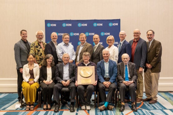
Well, I recognized myself at the first question. [At the ION awards luncheon, the MC gives a series of clues as to who the recipient of the Kepler Award is, starting from something that hardly anyone in the audience would know, then moving on to facts that are each better known than the previous one. Each time, whoever guesses the recipient stands and remains standing, until most of the audience is standing just before the final reveal.] I was nominated for that award very early on, more than 30 years ago. However, some folks were pretty dead set against me getting it, so it never happened. It’s very nice that they recognized that, shall we say, I had been overlooked. Not very many people stood up, because, as they told me later, most of the attendees thought that I’d already received a Kepler award long time ago. That was kind of funny.
Is it true that Charlie Trimble rode a bull at the Flying W Ranch in Colorado Springs during one of the first ION GPS conferences?
I think so. It was one of those mechanical bulls. Those parties were pretty wild.
You have many achievements in GNSS and five patents and have made significant contributions to many more projects. What are three or four that were particularly important in the history of GNSS?
Locator Net is the top one because of the challenge it involved. If we hadn’t proven to the FCC that there was a solution, the E911 mandate wouldn’t have gone into effect. Instead, they would have just made public announcements and said, “Look, when you call 911, you will be connected to a help center. It’s not an emergency call.” That would have impacted the whole cellular industry, too, so that one was probably our most impactful contribution.
I would put the WAAS next. That gets to the first RTCA SC-159 working group, which I chaired. We proposed three tracks for integrity to allow GPS to be used by civil aviation and all three got implemented. The first one was just as a supplemental aid to inertial navigation. The second one had to do with WAAS. The third one had to do with Receiver Autonomous Integrity Monitoring (RAIM). They are the foundation of all safety-of-life critical systems today. We were the ones who got WAAS working, using the bent pipe approach, but other significant contributions in those areas also came from NAVSYS.
Then InterNav, which is still one of our flagship products. The government started a push for ASPN and Modular Open Systems Approach (MOSA) and spent a ton of money on it. What was depressing when that started was that InterNav was already doing what they were requesting. We were offering that as a commercial product. They were right to say that open architecture and MOSA solutions were needed. We had already anticipated that and offered it as a commercial product. In fact, it’s been very successful. At that time, the only way you could do inertial navigation was to buy a COTS inertial navigation system from one of the providers; that was all integrated. InterNav was the first solution that allowed third parties to use just IMUs and inertial instruments with different sensors, using open architectures. That was revolutionary. What’s interesting is the elements of LocatorNet and InterNav that went into our new PNTaaS product.
Software-defined radios would be another one I’d champion. We did some of the first software-defined radios, including such products as the Tracking Widget (TIDGET) in 1991; the demonstration of GPS operation above the constellation on the USAFA Falcon Gold experiment in geo-transfer orbit, in 1997; and the High-gain Advanced GPS Receiver (HAGR) architecture in 1999. TIDGET, in a way, was a software-defined radio. NAVSYS led the charge on software-defined radios for GNSS.
PNTaaS, our new architecture, brings in technology that we developed for LocatorNet, for the WAAS, for software-defined radios, and for InterNav. So, it’s almost like a perfect storm that in 40 years NAVSYS has happened to be developing all the necessary ingredients to build this new capability. It is revolutionary. It’s breaking out of the L band [by utilizing existing commercial broadband satellite communications (SATCOM) signals as signals of opportunity (SoOP)]. I think that showing how we can use existing signals is the most important contribution that we can make.
The term is “signal of opportunity,” but they are existing signals that are operating in the C, Ku and Ka bands. Anybody who’s gone through the painful process of getting access to spectrum — which GPS has done a number of times and I’ve been on advisory boards at the time when it was done — knows that it’s impossible in today’s age to get navigation signal bands allocated in these highly valued portions of the spectrum. It is necessary to get out of L-band because of the congestion and the ease of attacking it and we see PNTaaS as being the solution.
I wrote an article about signals of opportunity 25 years ago that focused on TV broadcast antennas.
Rosum Corporation did that.
Yes, I remember. By the way, for InterNav, did you also have to develop data standards and data exchange protocols?
Yes. InterNav is an open architecture. All InterNav customers have access to the whole IDD standard interfaces. They can input their own data. They can control what data is used for aiding. It was designed from the get-go to provide that functionality.
Thank you very much!
You’re welcome!