Listen to this content
A roundup of recent products in the GNSS and inertial positioning industry from the July-August 2026 issue of GPS World magazine.
Receivers
1. GNSS Module Family
Designed for size- and power-constrained applications
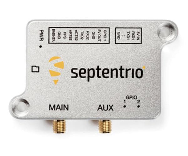
The mosaic-G5 P6 multi-frequency precise positioning module enables reliable positioning for commercial UAVs, robots and other size- and power-constrained applications. AIM+ Premium technology protects against intentional or unintentional GNSS jamming or spoofing attacks, while raw measurements support high-performance sensor fusion. The module is compatible with Galileo High Accuracy Service (HAS) for out-of-the-box decimeter-level positioning. Users can choose single- or dual-antenna configuration for accurate GNSS heading, enabling robust orientation and motion control in industrial automation applications such as autonomous machinery, robotics and precision guidance systems.
2. Galileo Modules
Enable addition of Galileo OS and PRS to receivers
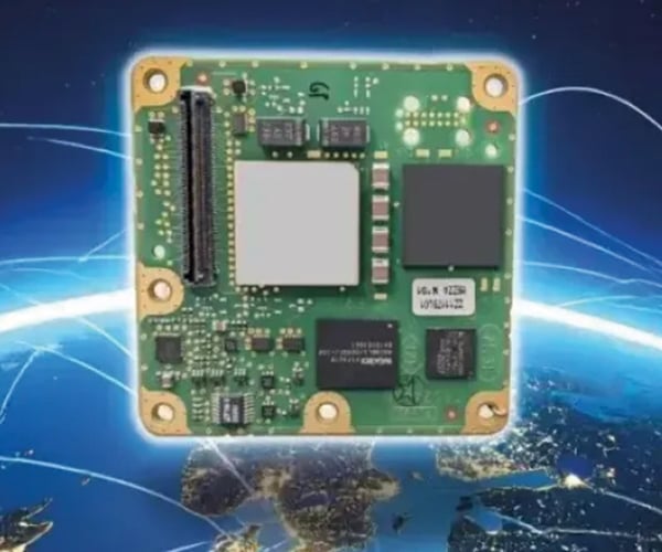
The small-form-factor Galileo OS (Open Service) or PRS (Public Regulated Service) sensors are designed to enhance GNSS receivers and resilient multi-sensor navigation systems by ensuring safer and more reliable satellite-based navigation. The Galileo PRS core module integrates a certified, single-chip, application-specific integrated circuit (ASIC) security module that incorporates all the necessary Galileo PRS security and navigation functions. It provides dual-frequency (E1/E6) iono-free Galileo PRS positioning, velocity and timing services. It also provides pseudorange and delta pseudorange raw data, along with GPS C/A (coarse acquisition). The low-SWaP (size, weight and power) digital solution is designed to work with any European GNSS receiver manufacturer seeking a standardized, easy-to-integrate Galileo module with which to develop their own GNSS receivers.
3. Inertial Measurement Unit
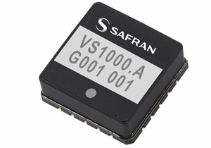
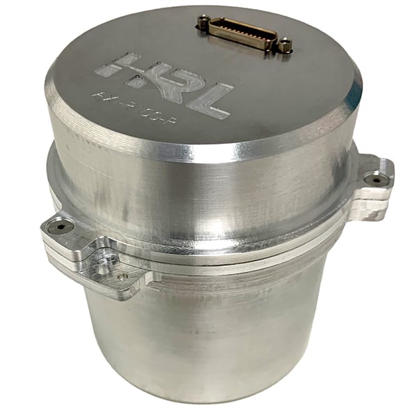
The AXI-R100 inertial measurement unit (IMU) provides near navigation-grade accuracy in a palm-sized package. Using silicon microelectro-mechanical systems (MEMS) technology, HRL’s gyros exceed the performance of many tactical-grade IMUs in the same or smaller package size and are manufactured in high volumes at wafer-scale. This near navigation-grade performance is available at a tactical-grade price. The new IMU is suitable for use in defense, aerospace and automotive applications, including missile-guidance systems and drone navigation, as well as for commercial automotive applications with higher levels of autonomy.
4. Pole-Mount Antennas
Aligns with modern multi-frequency GNSS architectures
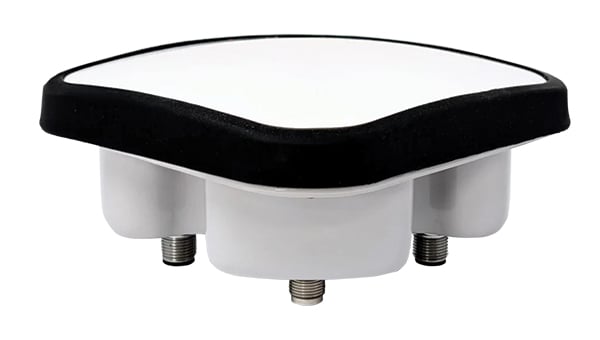
Calian has introduced two pole-mount variants of its controlled reception pattern antenna (CRPA) line: the CR8894PXF+ (L1/E1 + L2/E5b) and CR8854PXF+ (L1/E1 + L5/E5a). The new models increase installation flexibility across critical infrastructure, timing, marine and defense environments while maintaining Calian’s CRPA and XF+ interference mitigation performance. The pole-mount design integrates into fixed and marine installations such as communications towers, vessels and monitoring stations. Anti-jamming features include GPS and Galileo support, mitigation of three jamming sources per band, integrated XF+ filtering for out-of-band rejection and cross-band isolation, and real-time situational awareness messaging.
5. GNSS Antenna
Ultra-compact, dual-band, high-precision
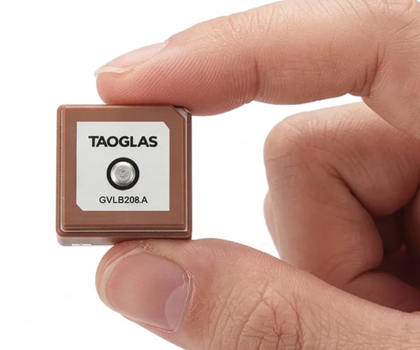
The GVLB208 series includes active and a passive dual-band GNSS L1/L5 stacked patch antennas. Combining a compact 20 x 20 x 8 mm footprint with concurrent L1/L5 support and stable right-hand circular polarization (RHCP), the antennas deliver reliable centimeter-level positioning. Their size, dual-band support and circular polarization help improve positioning performance without increasing device footprint. Using a single-feed stacked patch design, the antennas support concurrent L1/L5 GNSS bands, reducing multi-path interference in compled RF enviornments.
The passive GVLB208 features a single-feed architecture for dual-band performance and a pin-mount configuration that simplifies integration. The active AGVLB208.A includes active electronics and filters and is supplied with a 1.13 micro-coax cable and I-PEX MHF I connector for easy integration with multi-band GNSS modules.
Timing
1. Oscillator
For timing where traditional modules don’t fit
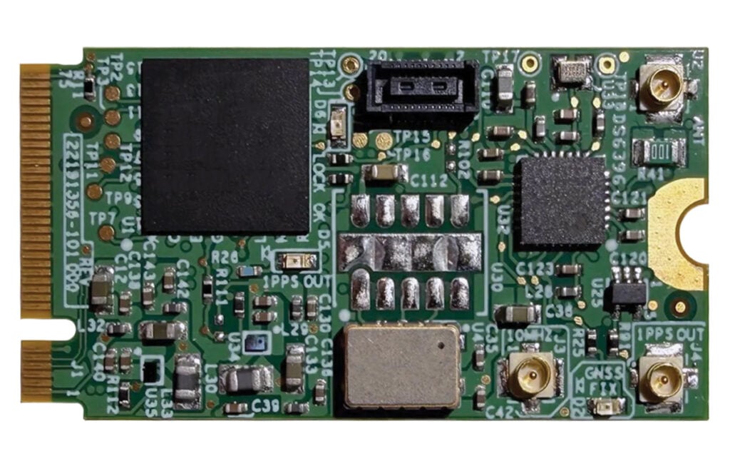
The µPNT GDO-1000 is a GNSS-disciplined oscillator built in the M.2 B-key form factor, suitable for low SWaP platforms. Measuring 22 x 42 mm and weighing less than 4 g, the GDO-1000 is designed for platforms requiring accurate timing in places where traditional timing modules do not fit or are too power-hungry, including defense and airborne platforms, unmanned systems, data center cards, and communications equipment. The µPNT GDO-1000 addresses these challenges with dual-frequency L1/L5 GNSS reception with microsecond-class 24-hour holdover enables precise, resilient timing in compromised conditions. The M.2 B-key form factor drops into modern compute platforms, time appliance cards, and embedded systems without custom mechanical design, drawing approximately half a watt. Patented AI and ML algorithms developed by the Jackson Labs team, now part of Viavi, predict and compensate for oscillator behavior across environmental conditions.
2. Defense Platform
Timing for mission-critical harsh environments
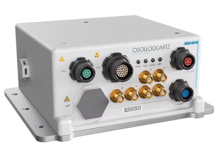
The ruggedSync Series OSA 5510, a ruggedized timing and synchronization platform engineered for defense and other harsh, mission-critical environments, tactical communications networks, mobile command centers, aviation systems and more. It combines PTP grandmaster and NTP server functionality with synchronization assurance and resilient holdover in a compact MIL-qualified platform. Multi-band GNSS support, encrypted and authenticated timing options, and environmental protection enable operation in contested and GNSS-denied environments where trusted synchronization must be maintained. Built to support resilient defense timing architectures, the OSA 5510 integrates advanced synchronization technologies and flexible mission-critical interfaces within a hardened platform compliant with MIL-STD-810H and MIL-STD-461G. The solution supports IEEE 1588v2 PTP, SyncE and secure NTP services, while programmable I/O and timecode interfaces, including STANAG, Have Quick, IRIG and PPS/CLK distribution, support diverse defense payloads and operational requirements. Optical and copper SFP/SFP+ 1G/10G interfaces and dual power feeds further enable deployment across modern high-bandwidth defense networks.
Mobile
1. Asset Tracker
Designed for size- and power-constrained applications
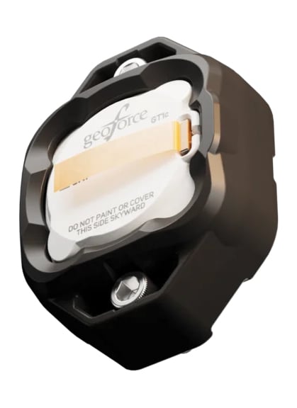
The GT1c enables rugged cellular equipment tracking at scale with a cost-effective, purpose-built design to complement Geoforce’s range of satellite tracking devices. The GT1c operates on AT&T’s network. The GT1c captures and feeds smart location updates to Geoforce’s mobile-enabled asset intelligence platform, providing field operations and asset managers with visibility into the location, movement and utilization of industrial assets and equipment. The GT1c has an encapsulated design, reinforced bezel, and intrinsic safety certification to ensure that it can survive in hazardous, heavy-vibration environments and extreme temperature ranges. It’s low price means customers can afford to track almost every asset class. The GT1c is suitable for oil and gas, construction, military and defense, industrial/manufacturing, waste management and equipment rental.
2. Upgrade Module
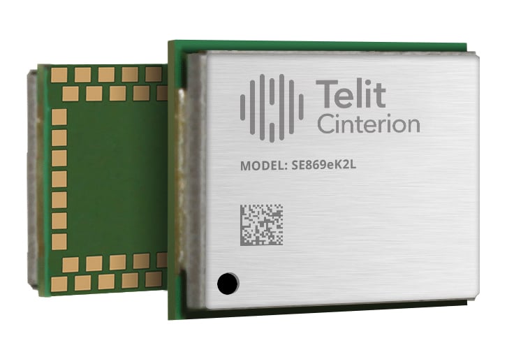
The SE869eK2L is a single-frequency L1 GNSS module designed to help device manufacturers upgrade legacy positioning designs with improved performance and cost efficiency, while preserving design continuity. Built on the Airoha AG3352 platform, the SE869eK2L supports GPS, GLONASS, Galileo, BeiDou and QZSS for reliable multi-constellation positioning. With approximately 1.5-meter accuracy and update rates of up to 10 Hz, it is suitable for connected devices that require dependable positioning without the complexity of higher end GNSS architectures. The SE869eK2L provides a straightforward migration path from Telit Cinterion’s SL869L-V2 and legacy xL869 modules. Its 12.2×16 mm footprint maintains pin-to-pin compatibility with the industry-standard form factor, so OEMs can extend existing designs while gaining updated performance and supply flexibility. The module is designed for a broad range of IoT and industrial use cases, including asset tracking, fleet management, routers and ell-tower synchronization.
Autonomous

1. Drone Landing System
Safe landings when GNSS signals are unreliable
An autonomous drone landing system for when GNSS signals are unreliable has been developed using ground-based ultra-wideband (UWB) positioning technology. It was developed by Omnisense through its European Space Agency-supported DroneHome program. Autonomous landing is a safety-critical phase for drone missions, particularly challenging when GNSS is impaired due to signal obstruction, reflection or interference (near tall buildings, in busy ports, or inside tunnels). The DroneHome program uses terrestrial radio positioning as a complementary navigation layer within the overall navigation system, so a drone’s position remains stable and predictable even in GNSS-challenged environments. In practice, this means autonomous systems can maintain controlled behavior instead of experiencing sudden navigation failures. The front-end design incorporates a UWB system-on-chip with low noise amplification, power amplification, switching, and antenna integration to deliver the required range and performance.
2. Flight Controller
Simplifies complex system integration of UAVs
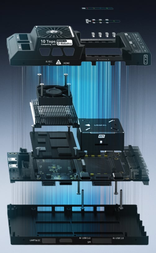
The USX51 platform system architecture combines the Pixhawk 6X flight controller with the D Robotics RDK X5 edge-computing module. It is designed to simplify complex UAV system integration for developers, research teams, and robotics engineers working on real-world deployment scenarios. The system integrates Pixhawk 6X and RDK X5 to support PX4-based UAV development for GNSS-denied, VTOL and multi-sensor applications. The Pixhawk 6X handles flight critical control functions, while the RDK X5 provides onboard computing capability for visual processing, sensor fusion, and autonomous-related workloads. It supports development scenarios including GNSS-denied navigation, VTOL mission platforms, multi-sensor integration, visual perception and tracking, and ROS2-based robotics workflows, and research and autonomous UAV development.
Transportation
1. Automotive Positioning
For sub-meter GNSS accuracy in challenging environments
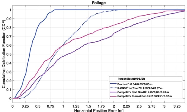
Precise+ delivers high-precision GNSS to advanced driver-assistance systems (ADAS) in urban canyons and under foliage. It is designed to deliver reliable high-precision positioning in environments where conventional carrier-phase tracking struggles. It targets cycle slips that can cause real-time kinematic and precise point positioning systems to lose lock in difficult environments — a major obstacle for ADAS, automated driving and robotics applications. Precise+ improves GNSS performance in challenging conditions, delivering sub-meter accuracy in scenarios where commercial receivers using live corrections typically produce multi-meter errors.
2. GNSS Modules
For ADAS and safety-critical architectures
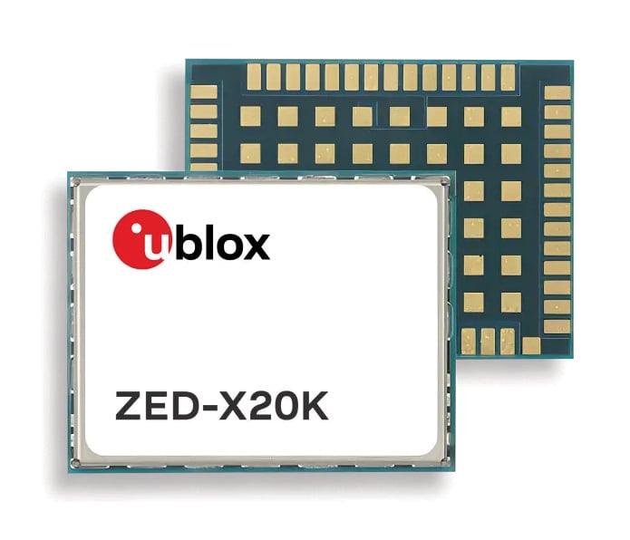
The ZED-X20K and the ZED-A20K address the engineering needs of both mass-market advanced driver assistance systems (ADAS) and safety-critical autonomous architectures. Both modules feature pin-to-pin compatibility for platform flexibility and simplifying product development across vehicles as well as jamming and spoofing detection. The ZED-X20K is designed for mass-market ADAS L3 and TCU/IVI applications, delivering lane-level accuracy worldwide using all-band GNSS and native Galileo HAS. By eliminating the need for paid correction services, backend infrastructure, or service management, it reduces total cost and accelerates time-to-market while maintaining global performance. For applications that require a functional-safety concept for GNSS sensors, the ZED-A20K provides ISO 26262 ASIL-B(D)-compliant GNSS RAW data simultaneously to high-performance QM positioning outputs within a single module.