Listen to this content
High-precision GNSS positioning is undergoing a fundamental transformation. What was once a specialist capability is rapidly becoming an accessible, scalable technology underpinning a wide range of applications, from construction and reality capture to IoT and autonomous systems.
For geospatial professionals, this shift is significant. Technologies that once improved productivity at the margins are now reshaping core workflows by enabling faster data capture while maintaining required accuracy standards.
This evolution is being driven by the convergence of three key developments: increasingly accessible high-accuracy positioning, the integration of multiple sensors, and the growing importance of resilient positioning infrastructure. Together, these developments are redefining not only how positioning is achieved, but also how it is trusted and deployed at scale.
Expanded Access to High-Precision Positioning
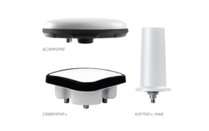
One of the most significant changes in recent years is the widening availability of centimeter-level positioning. Advances in receiver technology have reduced size, cost, and power consumption, enabling high-precision GNSS to move beyond its traditional domain.
“High-precision positioning is no longer limited to high-end professional equipment,” explains Christian Miranda, GNSS expert and product manager at Leica Geosystems, part of Hexagon. “Today, compact and cost-efficient receivers allow this capability to be integrated into a much wider range of applications, from IoT devices to autonomous systems.”
For geospatial users, this directly translates into efficiency gains when leveraged alongside GNSS-focused software and cloud services.
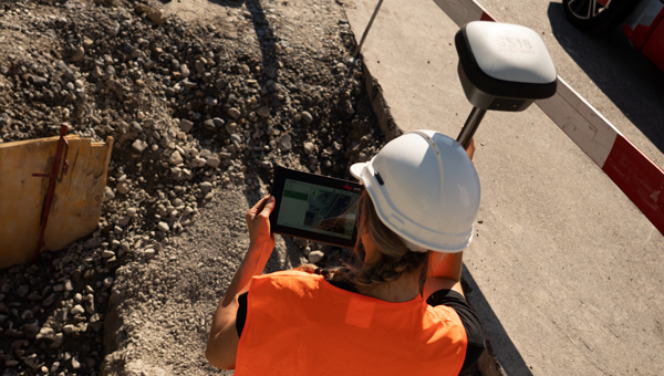
“Surveyors and other geospatial professionals will benefit the most from access to these receivers when they’re embedded in a strong software and cloud ecosystem,” continues Miranda. “For example, smart RTK rovers paired with task-focused surveying and construction software for the field and cloud services that make data handling easier.”
This opens another layer of performance, he says, enabling professionals not just to achieve high accuracy, but to work faster, validate data in real time, and seamlessly connect field and office workflows.
At the same time, correction services have evolved into a core and widely available component of positioning solutions. Technologies such as real-time kinematic (RTK) and precise point positioning (PPP), once deployed independently, are increasingly combined into hybrid approaches that automatically adapt to connectivity, geography, and application requirements.
“The industry has moved beyond choosing between RTK or PPP,” Miranda notes. “The value today lies in solutions that combine these technologies, so that positioning performance can be maintained under changing conditions and in more locations.”

This evolution is closely linked to the maturation of correction service infrastructure. Over the past two decades, services such as Hexagon SmartNet have developed into highly dense, continuously monitored networks, supported by advanced processing engines. These systems transform raw satellite observations into consistent, high-accuracy corrections, forming the computational backbone of modern positioning workflows.
Multi-Sensor Integration and Intelligent GNSS Processing
As GNSS expands into more complex environments, the industry’s focus is shifting from raw accuracy towards reliability. Delivering centimeter-level precision in open-sky conditions is no longer sufficient; the challenge lies in maintaining trustworthy positioning in real-world environments affected by obstructions and signal interruptions.
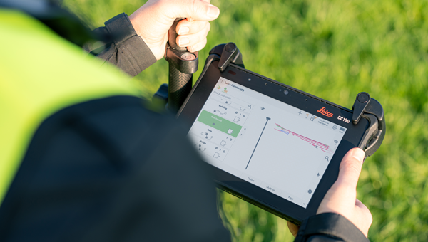
Multi-sensor integration, combined with continuous advances in GNSS signal processing and algorithms, has become central to addressing this challenge.
The integration of inertial measurement units (IMU) with GNSS is now standard across many high-end surveying solutions. Early innovations in this area, like the Leica GS18 T and I RTK rovers, demonstrated how inertial sensors, imaging, and GNSS could enable accurate measurements of previously inaccessible points. Today’s mobile mapping systems are also a prominent example of how GNSS, inertial navigation systems (INS), lidar and imaging technologies work together to continuously capture georeferenced data across widespread, dynamic environments.
However, this progress is not driven solely by sensors, but also by improvements in how GNSS observations are processed and interpreted.
“Anyone can achieve very good accuracy under ideal conditions,” says Miranda. “The real challenge is delivering reliable and trustworthy results in difficult environments. That’s where sensor integration and improvements in GNSS processing and algorithms are essential to performance, increasing availability and reliability. The use of AI-powered GNSS algorithms will provide further improvements.”
These developments reflect a broader shift: the emphasis on a wider sensing ecosystem that uses multi-faceted approaches to ensure continuity and confidence in positioning.
Correction Services as Critical Infrastructure
As positioning becomes embedded in a wider range of applications, GNSS correction services are evolving into essential infrastructure.
Modern networks deliver centimeter-level accuracy as a baseline capability, but their true value lies in reliability and operational continuity. Network densification, redundancy, and advanced modeling techniques all contribute to maintaining consistent performance, even in demanding conditions.
Behind the scenes, these services have also undergone significant architectural changes. Distributed, cloud-based processing environments now support large-scale operations, allowing correction services to maintain availability and performance even when individual reference stations are disrupted.
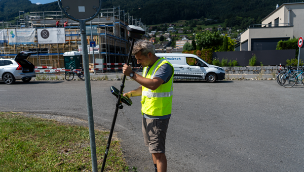
For users, this complexity is largely invisible. The expectation is that positioning works when needed, without requiring intervention.
Bernhard Richter, vice president of product management for Geomatics at Leica Geosystems, places this shift in a broader context:
“We are seeing positioning move from a measurement tool to a foundational layer across applications that need high-accuracy positioning in real-time to function. In that context, reliability, scalability, and data integrity are just as important as accuracy. Correction services have to be engineered accordingly.”
The expansion of GNSS into new domains is also changing infrastructure requirements. Applications such as IoT and autonomous systems introduce different usage patterns, including large numbers of connected devices and continuous operation. Supporting these demands requires not only robust networks but also adaptable service models and architectures, backed by sustained investment in both terrestrial and space-based infrastructure.
Building Resilience in an Era of Interference
As reliance on GNSS grows, so too does exposure to interference. Jamming, spoofing, and other forms of signal disruption are increasingly encountered in real-world environments.
In practical terms, interference can lead to loss of fix, degraded accuracy or undetected errors, outcomes that directly impact data quality and project timelines. This has elevated resilience from a niche consideration to a core requirement for GNSS systems.
Testing under controlled yet realistic conditions highlights both the risks and the available solutions. At Norway’s annual Jammertest – the world’s largest open PNT/GNSS resilience test — organizations, including Leica Geosystems, have evaluated their GNSS technologies under real interference scenarios. These tests have shown that receivers equipped with advanced detection and mitigation capabilities can maintain positioning performance even under severe jamming, sustaining high levels of fixed solutions and centimeter-level accuracy.
“Interference is becoming more common, and it directly affects the reliability of positioning,” says Miranda. “That’s why detection and mitigation capabilities are now essential components of GNSS infrastructure, and a critical part of what we offer to our customers.”
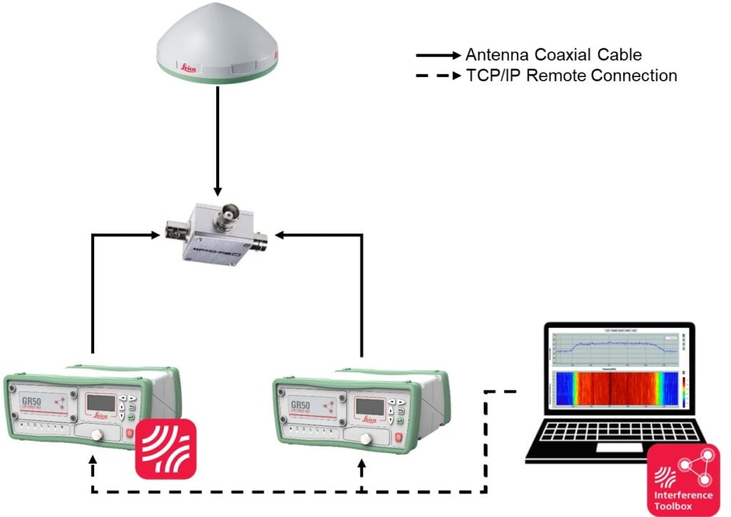
These capabilities rely on a combination of monitoring, detection, and mitigation. Modern systems can analyze the radio frequency environment in real time, identify interference patterns, and apply adaptive filtering techniques to preserve signal quality.
From a network perspective, resilience also depends on ensuring the integrity of reference station data. Technologies that detect and flag compromised signals, such as spoofing, help prevent corrupted data from propagating and protect the overall system.
Richter adds, “Trust in positioning is built across the entire chain, from satellites to sensors to correction services. As GNSS is used in more critical applications, ensuring the integrity of that chain becomes a key responsibility.”
Towards Ubiquitous and Trusted Positioning
Looking ahead, the next generation of GNSS positioning will be defined by accessibility, integration, and reliability.
High-precision positioning will continue to expand into new applications and user groups, supported by more compact and cost-efficient hardware. Hybrid correction approaches will provide consistent performance across varying conditions. Multi-sensor integration will enhance robustness and extend capabilities. And resilient infrastructure will underpin trust in positioning data.
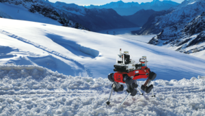
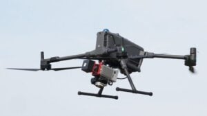
For many early adopters, this is already a reality, as GNSS becomes embedded across workflows ranging from drone-based surveys to large-scale mobile mapping and connected construction environments.
These developments represent both an opportunity and a shift in expectations for surveyors and geospatial professionals. High-precision positioning is becoming more widely available but is also increasingly embedded in applications, requiring systems that deliver across a range of conditions.
As Richter concludes:
“The direction is clear: positioning is becoming more accessible, more integrated and more critical to how industries operate. For geospatial professionals, the priority is ensuring that this capability delivers consistent, trusted results in everyday practice.”