NGS revises NOAA report on working in the modernized NSRS
April 7, 2021
The National Geodetic Survey (NGS) has revised an important technical document on the modernized National Spatial Reference System […]
Read More
The National Geodetic Survey (NGS) has revised an important technical document on the modernized National Spatial Reference System […]

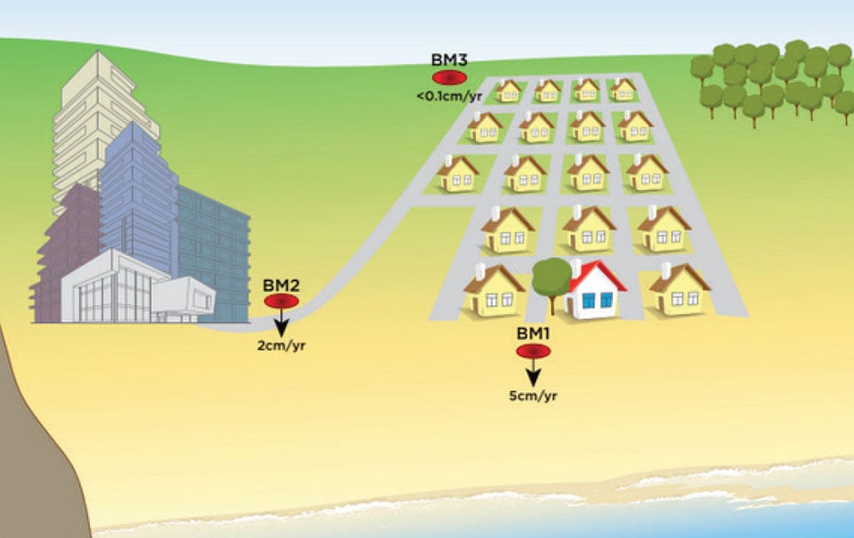
Editor’s note: GPS World explored use of the new system from Geomatics in the March 2015 issue. Geomatics USA from Gainesville, Fla., […]


Follow Us