A new angle on mapping cliffs on California’s shore
March 26, 2021
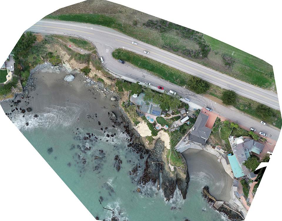
Cliff surveys are traditionally performed with fixed-wing aircraft that collect nadir photos. However, a photogrammetry company accurately triangulated […]
Read More
Cliff surveys are traditionally performed with fixed-wing aircraft that collect nadir photos. However, a photogrammetry company accurately triangulated […]

SimActive Inc., developer of photogrammetry software Correlator3D, has partnered with Midwest Aerial to perform damage assessments of Hurricane […]

EuroTube is Europe’s first testing ground for high-speed vacuum maglev transportation. In May, a WingtraOne drone conducted a […]
SimActive Inc., a developer of photogrammetry software, is offering a new free data-processing service using Correlator3D. New users […]
Lehmann Aviation has rolled out a new version of its OperationCenter, a flight preparation and mission control software program for automatic […]


Follow Us