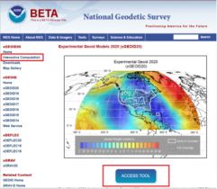
NGS releases annual experimental geoid models and gravity interpolation tools
February 3, 2021
My last column highlighted an ArcGIS web application that incorporates various datasets and data layers to assist surveyors […]
Read More
My last column highlighted an ArcGIS web application that incorporates various datasets and data layers to assist surveyors […]


My last column described a new National Geodetic Survey (NGS) webtool for obtaining geodetic information about a passive […]
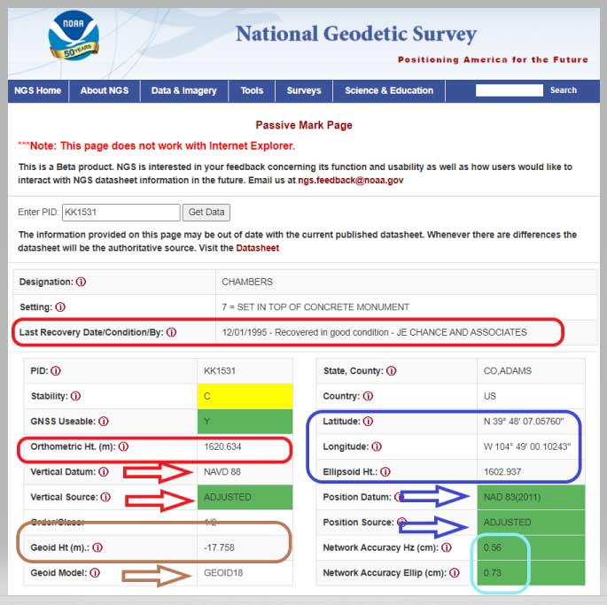
NGS has developed a new beta tool for obtaining geodetic information about a passive mark in their database. […]

Individuals who use GNSS today may not know the significant advancements that have been accomplished over the past […]

A new study for the National Geodetic Survey (NGS) reviews and validates airport surveys from a safety perspective. […]

The National Geodetic Survey (NGS) recently announced two new items related to the modernized National Spatial Reference System […]

This column will address why users will be required to perform GNSS occupations when submitting a leveling project […]


Follow Us