Golden Software releases updated 3D surface mapping package
January 14, 2021
Golden Software has improved visualization and other functionality in the new version of its Surfer gridding, contouring and […]
Read More
Golden Software has improved visualization and other functionality in the new version of its Surfer gridding, contouring and […]
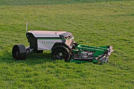
A new start-up has introduced an autonomous lawn mower to bring intelligence, automation and sustainable solutions to commercial […]
RedTail Lidar Systems partnered with an engineering firm to demonstrate the RTL-400 lidar system’s high-resolution, high-accuracy mapping capability. […]

The world of mathematics has always been a mysterious one. It is universally loved by those who enjoy […]
Mobile GIS Services (MGISS) has equipped a team of urban surveyors with new satellite positioning systems to accurately […]
Mobile GIS Services (MGISS) has been awarded a place on the United Kingdom government’s procurement platform G-Cloud. Designed […]

The creed “Neither snow nor rain nor heat” may apply to postal workers, but it also could apply […]

The National Governors Association has partnered with Esri to publish a comprehensive update to its interactive COVID-19 State […]


Follow Us