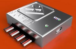
Skyfish unveils UAV computing, navigation and sensor platform
October 1, 2018
UAV technology developer Skyfish has introduced a computing platform for commercial drones that fully automates crucial infrastructure inspection […]
Read More

UAV technology developer Skyfish has introduced a computing platform for commercial drones that fully automates crucial infrastructure inspection […]

Topcon Positioning Group has introduced software to facilitate the data-processing workflow for UAV (unmanned aerial vehicle) infrastructure inspection. […]
Many of us have been searching for fast, easy and cheap ways to collect oblique imagery and video, and build 3D models. Remote GeoSystems has developed a system that may address some of those needs at a reasonable price.

Sentera LLC, a designer of sensors, software, and unmanned aerial vehicles (UAVs), has been granted a Section 333 […]
Follow Us