Precisely GIS software used by UK police at G7 Summit
October 25, 2022
Precisely announced that Devon and Cornwall Police leveraged its GIS software to enhance safety measures during the 2021 G7 Summit.
Read More
Precisely announced that Devon and Cornwall Police leveraged its GIS software to enhance safety measures during the 2021 G7 Summit.
GeoComm is now a Select Technology Partner in the Amazon Web Services Partner Network (APN). The APN is […]

The Maptitude 2020 U.S. Census Blocks Groups data is now available for the entire United States, according to software provider […]
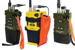
A roundup of recent products in the GNSS and inertial positioning industry from the April 2020 issue of […]

Touch GIS has released the Touch GIS app for iPhone and iPad. Users can explore the app’s features […]

New app gives field crews a fast, easy way to record information while mobile Esri has released ArcGIS […]
Esri is partnering with the Jane Goodall Institute to develop a set of tools that will help communities […]
A major use of remote sensing data is to compare images of an area taken at different times […]


Follow Us