
U.S. geodesists urgently needed
December 8, 2022
Editor-in-Chief Matteo Luccio discussed the geodesy crisis with Everett Hinkley, who works for the federal government and serves as a subject-matter expert on several high-level boards.
Read More
Editor-in-Chief Matteo Luccio discussed the geodesy crisis with Everett Hinkley, who works for the federal government and serves as a subject-matter expert on several high-level boards.

A goal of mine has always been to get individuals interested in obtaining a better understanding of geodesy. I hope this newsletter helps whet the appetite of some individuals to obtain a better knowledge of geodesy.

On Aug. 5, the National Geodetic Survey (NGS) stated it will be updating the NOAA CORS to be […]
Ask surveyors why they became engaged in the profession and why they had continued with it, most will centralize on one aspect: working outside.
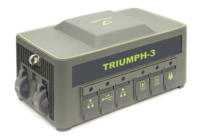
Javad GNSS has launched the TRIUMPH-3 receiver for surveyors and geodesists. It is capable of efficient tracking even […]

Tallysman, a manufacturer of high-performance GNSS antennas, has introduced two additions to its VeraPhase line of precision antennas. […]
The American Association for Geodetic Surveying (AAGS) has undertaken an effort to explore creating a geodetic certification program, and asks professionals to take part in a survey.

The world of sharing positional information is filled with scenarios like “I got a cm and you got a cm, but our centimeters differ by a meter.” If our modern positioning systems are so capable, then virtually all positional data integration should be a snap. Unfortunately, that is often just not so. The failure in many cases is a lack of knowledge on the part of many GNSS users of basic principles of geodesy and geodetic surveying guidelines and providing complete metadata.


Follow Us