
Europe awards seven contracts for alternative PNT demos
October 13, 2021
A notice of award was posted Oct. 11 by the European Union for seven contracts to six different […]
Read More
A notice of award was posted Oct. 11 by the European Union for seven contracts to six different […]
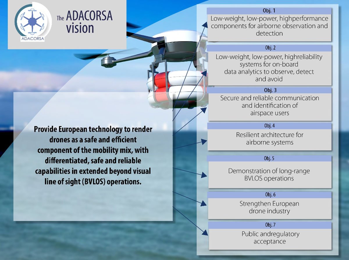
Celestia Technologies Group (CTG) is taking part in the ADACORSA project, a European initiative designed to unlock the […]

Cepton, a provider of automotive lidar solutions, will showcase its automotive-grade, long-range Vista-X90 lidar device at two upcoming tradeshows in Europe.
A new European project is researching automated collection of geodata and production of high-definition maps. The GAMMS project […]
Europe’s EGNOS satnav system has been providing safety-of-life services for 10 years. EGNOS, the European Geostationary Navigation Overlay Service, […]
Free-to-use maps from more than 40 European countries will be made available through a new online gateway. Open […]

“In some specific cases, e.g., for critical infrastructures and applications requiring both continuous availability and fail-safe operations, GNSS […]

Esri is offering two major capabilities in Site Scan for ArcGIS that will enable governments and critical infrastructure […]


Follow Us