EagleView and Skyline to offer new imagery capabilities within Skyline Software
September 7, 2021
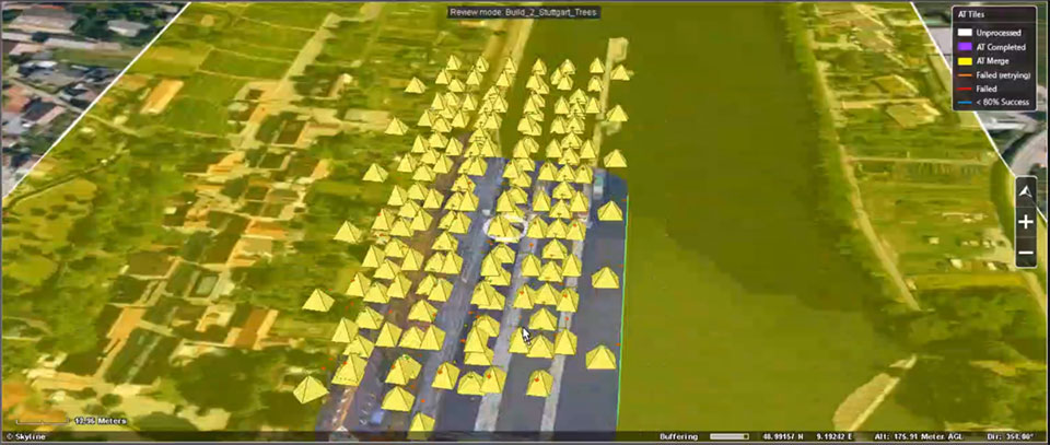
EagleView and Skyline Software Systems have partnered to enable customers to visualize their geospatial data in new ways.
Read More
EagleView and Skyline Software Systems have partnered to enable customers to visualize their geospatial data in new ways.
Drone company PrecisionHawk has announced a partnership with EagleView, a provider of aerial imagery and data analytics for […]

Australian geospatial startup Spookfish has won a major Asia Pacific industry award for exporting imaging technology to the […]
EagleView Technologies has captured post event aerial imagery of two million properties in the state of Florida following […]

EagleView Technologies is actively flying to acquire post-storm imagery in Florida following Hurricane Irma. With more than 20 […]
EagleView, provider of aerial imagery and data analytics for government and commercial industries, has acquired OmniEarth, developer of machine […]
Pictometry International Corp. has secured an order from the Los Angeles Region – Imagery Acquisition Consortium (LARIAC) to provide digital […]


Follow Us