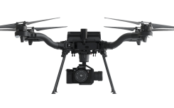
Auterion delivers new high-precision UAV mapping capabilities
May 3, 2022
Auterion has introduced new capabilities for high-precision mapping missions and automated, end-to-end data workflows to make mapping more […]
Read More

Auterion has introduced new capabilities for high-precision mapping missions and automated, end-to-end data workflows to make mapping more […]

Auterion, the company building an open and software-defined future for enterprise drone fleets, has partnered with Phase One, a developer and manufacturer of medium and large format aerial photography systems.

Auterion, an open-source drone software platform provider, has partnered with C2 Group — a program, project and construction […]

Esri is offering two major capabilities in Site Scan for ArcGIS that will enable governments and critical infrastructure […]

NXP and Auterion join forces to enable next-generation secure drone fleets with automotive certified solutions, high-reliability networking, and […]

Two new small unmanned aerial systems (sUAS) are available to the U.S. government defense and security markets. Auterion […]

GE Aviation and Hybrid Project team to provide commercial high-endurance vertical takeoff and landing (VTOL) UAV, with Auterion […]

Auterion and Impossible Aerospace are collaborating to bring to market the US-1 UAV, which has a two-hour flight time. Auterion […]
Follow Us