Advancements in satellite-driven farming
January 31, 2022
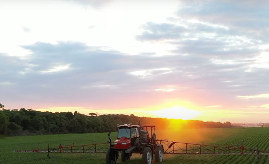
guidance for farm vehicles must be consistently accurate at the decimeter-level, lest the machines damage the valuable crops that they are designed to service.
Read More
guidance for farm vehicles must be consistently accurate at the decimeter-level, lest the machines damage the valuable crops that they are designed to service.
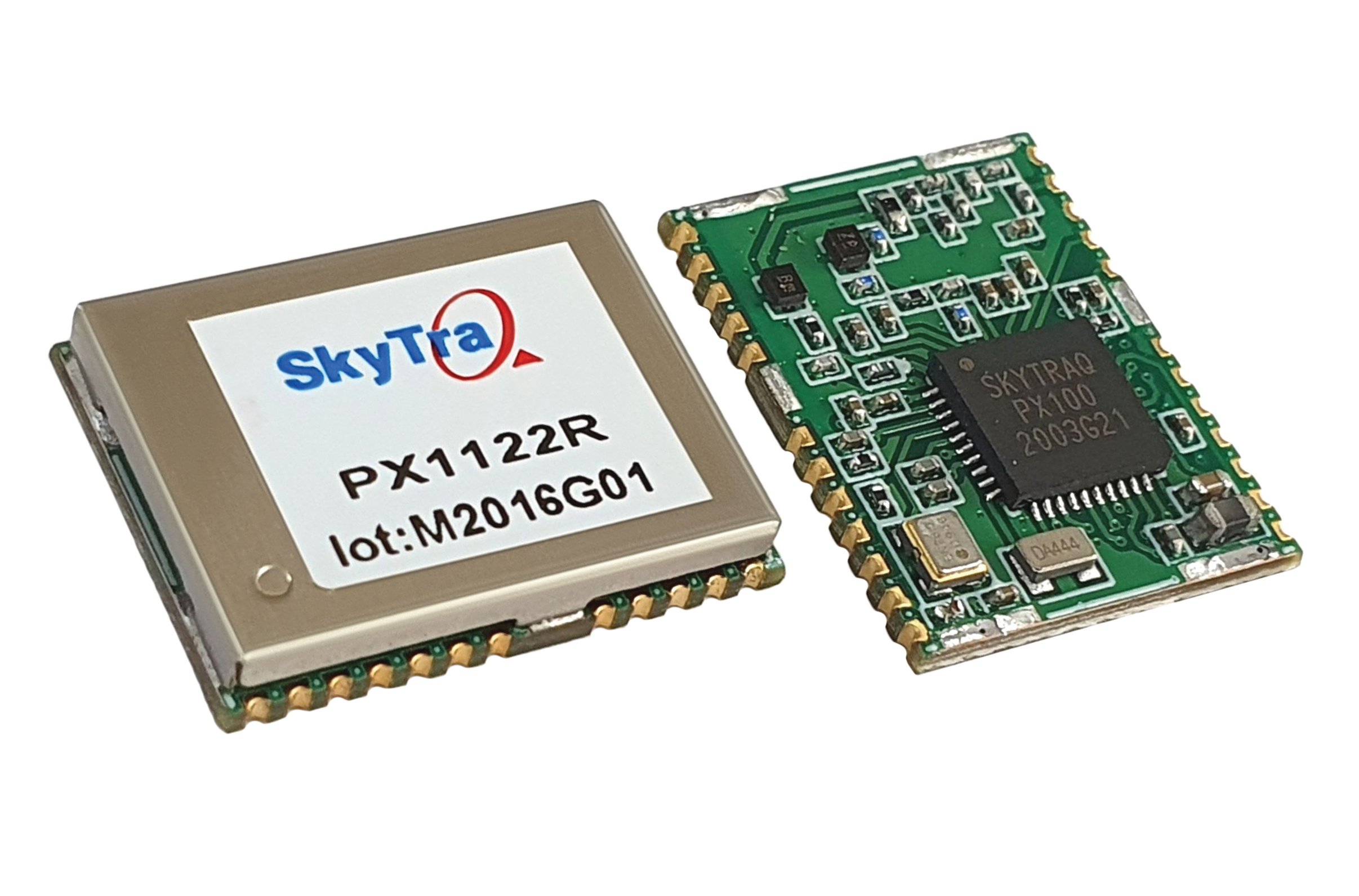
SkyTraq’s chipset is designed to be common hardware for different target applications enabled by customized software.

Datumate, a photogrammetry solution and 3D mapping software developer, has released its updated DatuSurvey 5.5 software, which offers […]
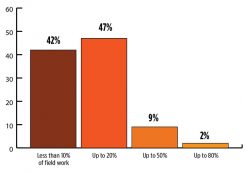
Health compares favorably with rest of industry 2018 State of the GNSS Industry survey respondents who identified themselves […]

By Nesreen I. Ziedan, Zagazig University, Egypt / Presented at ION GNSS+ 2017, September 2017 Multipath is a […]

Spirent Communications’ testing systems are being used by the European Union TREASURE project (Training, REsearch and Applications network […]
In Geospatial Solutions’ sister publication, GPS World magazine, I’ve written quite a bit about how high-precision GNSS is […]

Surveyors are short-term, project-based data generators. On the other hand, GIS professionals are long-term data managers. Therefore, for surveyors, their data doesn’t require accuracy, it requires precision. On the other hand, GIS professionals value accuracy much more, or at least they should.


Follow Us