Surveyors, not the tools, define the profession

Many have debated how the surveying profession has morphed into something less than what our predecessors would have called surveying.
In earlier times, the surveyor was an honored figure in the community and held in high regard, like the local doctor and clergy. Surveyors had the final word on boundaries and the limits of a family’s land holdings, so they were treated like royalty.
Measuring devices were simple yet complicated enough for only the trained person to understand how boundary lines were determined. Surveyors during those times depended much on natural monumentation and terrestrial features; these items made for solid and definable boundaries. Measurements along these features were to be completed only by surveyors and their means of determining distances.
Much has changed since those centuries past, including the reputation of the surveying profession. No longer are we mentioned in the same breath as doctors, clergy and lawyers. Even engineers are seen as “more professional” than surveyors. Many have debated how the surveying profession has been degraded from the noble status it once enjoyed and morphed into something less than what our predecessors would call surveying.
There are many layers to each of the previously described professions, but they all have several things in common: each one relies on data collection, analysis, and professional opinion. Each of these steps requires a specific skill set that includes education and experience. Nowhere in this process does it allow for advancing technology to completely replace any of these steps.
The evolution of technology and associated tools may help improve the profession, but it will not replace the knowledge necessary to be considered a true professional. Data collection within most professions is the biggest beneficiary of technology; surveying is a testament to these advancements. The breakdown, however, is the availability of the technology to the public and turning non-practitioners into low budget pseudo-surveyors.
What makes us professionals
Here is the abridged version of the definition of “professional” according to the Merriam-Webster Dictionary Online:
professional (adjective)
: of, relating to, or characteristic of a profession
: engaged in one of the learned professions
: characterized by or conforming to the technical or ethical standards of a profession
professional (noun)
: one who is professional
: one who engages in a pursuit or activity professionally
Similar professions have several examples of how the collection of data is a separate process and experience level from its analysis. Consider the following:
MRI technicians train for their jobs through education, interning and experience. They know how to place patients within the equipment, shield them, apply the rays, and produce the scans as required by their job description. In simple terms, they are data collectors of patients’ medical conditions. Technicians do not analyze the scans nor offer any opinion on the prognoses of the patients. They are, however, relied upon to obtain the proper scans correctly and efficiently for review by doctors.
Staff accountants or clerks are typically charged with data entry, maintaining ledgers and journals, and verifying data/entry accuracies. Often, clerks organize invoices, statements, and other receivables for input into clients’ accounts. Much of the work for this position is electronic and relies on the employees to be savvy with spreadsheets and able to import various data formats and spot suspect data. Once this work is completed, it become the responsibility of certified public accountants (CPAs) to review and certify the information. The key role here, however, is the accurate compilation of the accounting data.
Paralegals play a key role in doing the heavy lifting of data collection for lawyers. Paralegals perform client and case research, interview witnesses, handle discovery of case information, and draft many of the documents needed by lawyers. They are tasked with assembling exhibits, delivering and filing necessary court documents, and helping with trial preparation. While they cannot express legal opinions on any case matter, it is the paralegals’ work that lawyers use to develop case strategies. Once again, the data collection is the key to the success of the lawyers’ work.
Professional surveyors are no different from doctors, accountants, and lawyers in these examples. They rely on data collection obtained by experienced staff trained to operate sophisticated instruments and data collectors.
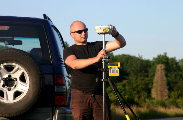
Field technicians often serve as surveyors’ eyes, so specific training is necessary to ensure that they can accurately locate the required information. Technicians, however, cannot offer legal opinions on the location of land and parcel boundaries.
This function is solely on the shoulders of land surveyors, who are licensed specifically in that jurisdiction to apply legal principles and case law to boundary issues.
There is one in every crowd — the North Carolina lawsuit
For those who are not paying attention, we are solidly in the 21st century and fully engulfed in the proliferation of geospatial data. Surveyors remain at the forefront of these technological advances with a plethora of tools and techniques being introduced on a regular basis.
These tools and associated software are much advanced compared to their earlier surveying instrument counterparts, but through extensive programming and easy-to-use interfaces, this equipment may seem simple to use to the layperson. The elder surveying generation likes to refer to newer technicians as button pushers, because the users perform no true calculations.
Yes, there are necessary checks and balances even with the new equipment, but the knowledge to operate these instruments is user-friendly and intuitive. So what happens when the technology is used by someone who is not a surveyor?
Among the hazards of making these newer tools and software widely available is how they are used by the non-professional public. As many surveyors have already read about in the news and social media, a UAV operator in North Carolina has filed suit against the NC Board of Examiners for Engineers and Surveyors.
The board previously ordered the operator to discontinue his UAV flights that engaged in mapping, surveying and photogrammetry services. The operator had been providing images to realtors and homeowners that depicted graphical lines representing property lines, but also included a disclaimer that the product was not intended for surveying purposes. The board ruled he was surveying without a license. The operator is now suing the board and accusing them of violating his First Amendment rights of free speech.
This case is a high-tech example of what surveyors have faced in the past with overzealous owners of metal detectors. Many instances of low-budget outfits and even fence installers have been brought before state licensing boards because they misrepresented surveying services.
It should also be noted that survey field crews who use their equipment during off hours to help family or friends with property location without their licensed supervisor’s knowledge face the same consequences. While the “corner finders” are somewhat harmless and get a slap on the wrist from licensing boards, it is the high-tech offenders who are creating much of the harm to the public.
These situations with unlicensed surveying practices have greatly increased simply because of the available technology and low cost of entry. While GNSS receivers, robotic total stations, and associated data collectors are still quite expensive, new remote-sensing applications are being produced using consumer-grade equipment and advancing software. As technology continues to increase based upon miniaturization and capability, the costs also continue to decrease based upon volume of sales.
Can I get that UAV in purple like my phone?
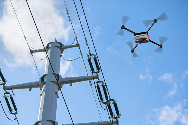
Leading the charge into non-licensed use of new technology is the UAV and the new standard use of GPS technology within its guidance system of reasonably priced units. Hobby planes and helicopters have been around for years but required lots of skill and space to fly and were quite expensive. The invention of the multi-rotor UAV with integrated GPS has created an easy-to-fly vehicle with lots of capability.
Couple this new vehicle with a high-resolution camera for photos and video; now it allows amateurs to be aerial cinematographers. Image storage space is not an issue due to increased SD card capacity and speed.
A well-built UAV with all these capabilities is now very affordable and available everywhere. This revolution has led to larger format platforms with more rotors and heavier payloads for more sophisticated cameras and sensors. Once you have the photos and video, now you must do something with them.
The advancement of software technology for processing photos, video, and remote sensing modules has become the hottest ticket in site modeling. The combination of the UAV’s capability and the software’s output enables trained pilots and software technicians to provide orthometric-based imagery. This imagery was previously completed by airplanes and cameras costing hundreds of thousands of dollars and processed by technicians on high-end computers using years of skill and experience.
This entire operation can now be completed by one person with less than a $5,000 initial investment. This is a far cry from the funding needed in years past to outfit a survey vehicle with the necessary equipment and personnel to do this same project.
Enter the FAA and new rules for flying unmanned aircraft. After much consideration, the FAA instituted guidelines for flying UAVs along with requiring a pilot’s certification to fly for commercial purposes. They also specified limits to UAV sizes and payloads, and limited flights to 400 feet above the ground.
Many companies have purchased UAVs to provide aerial photos of their own facilities and projects, but fail to realize that publishing their images or videos qualifies them as a commercial user. Unfortunately, these regulations are much like driving a car without a license or insurance — it is only against the law if one is caught.
The iPhone 12 Pro’s lidar scanner
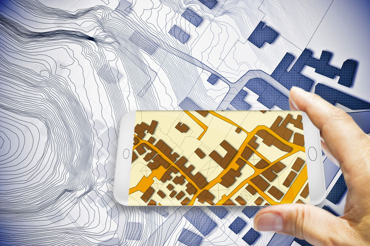
Another technology that will be catching on soon is lidar imagery from smartphones. The Apple iPhone 12 Pro and Pro Max contain sensors capable of capturing lidar data that is easily imported into computer drafting software. Several phone apps are also available for integrating this data into survey drawings. Geospatial data is literally at your fingertips.
50 states, 50 rulebooks
Rules and policies are put in place to regulate various professions and surveying is no different. The goal of these rules is simply to protect the public. Unlawful practice by non-licensed and/or non-qualified persons is a detriment to public safety.
The question is often raised about professional surveying licensure and the ability to practice in multiple states. Each state differs in statutory rules regarding boundary surveys. The colonial states (and Texas) follow a metes-and-bounds standard while the remaining states generally adopt a PLSS rule. Local surveying methods, terrain challenges and early settlers often affected the statutes enacted by each state, therefore variations in licensing must be applied to applicants.
However, the guiding principles for land surveyors remain the same in all states to protect the public. Boundary establishment and retracement is the sole responsibility of licensed land surveyors.
The tools of the trade are a completely different matter. Controlling the surveying services would be easier if the equipment and supplies necessary to do the work were only available to licensees, but the free market will never let that happen. If a company has $30,000 and wants a robotic total station but has no surveying license, the dealer will not stop the sale. When we drop the price tag to an $800 UAV purchase for performing aerial photography, no one bats an eye. As the cost of equipment continues to fall, the number of unlicensed users will climb.
‘Men have become the tools of their tools’ (Henry David Thoreau)
The point of this topic is that surveying is not about the tools necessary to complete the task. Surveyors carried out their work for thousands of years before electronic instruments and can continue to do so if they choose. The advancement of the equipment and the technology has made it easier for surveyors to do their work, but the true meaning of the task lies within the profession.
Boundary analysis and determination is the responsibility of land surveyors. Data collection for that analysis can be completed by technicians using a variety of measuring tools. The team works together to complete the surveying process.
Anyone can buy the tools; that, however, does not make them qualified to use them properly. It is not reasonable for one to buy a scalpel and offer brain surgery with a disclaimer. Ask any surveyor; there are some boundary retracements that are the equivalent of brain surgery. And we do not get to put a disclaimer on it.


Follow Us