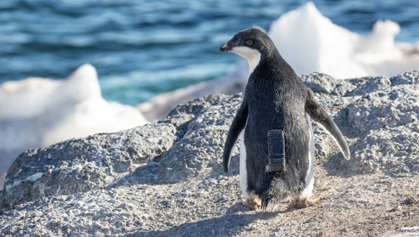
Your behavior appears to be a little unusual. Please verify that you are not a bot.


Mapping

Image: Bluesky

Bluesky, SkyFi collaborate to broaden aerial imagery access

April 6, 2023

NV5 Geospatial maps North American shorelines and riverine environments

April 4, 2023

NASA-JPL prototype of POINTER base units on a first responder vehicle. The magneto-quasistatic fields they generate can be detected through walls, where legacy indoor positioning technologies fail. (Image: Jet Propulsion Laboratory)

Positioning through walls: DHS and NASA partner on indoor positioning and location solution

March 28, 2023

Image: SimActive

SimActive software enhances utility mapping

March 24, 2023

This article is tagged with , , , , and posted in Latest News, Mapping
On Feb. 6, a magnitude 7.8 earthquake struck Turkiye and northern Syria creating enormous damage throughout both countries.

Monitoring earthquakes, eruptions and avalanches to mitigate risk

March 21, 2023

Trueview 720. (Image: GeoCue)

Launchpad: Navigation software, UAV and lidar systems

March 20, 2023

Image: CHC Navigation

Guide, Assist, Automate: Why GNSS remains a key element for most construction automation applications

March 14, 2023

Alex Murdaugh (Image: Pool reporter photo from trial)

Phone location data is center stage at Murdaugh trial

February 23, 2023